

- Usage in publication:
-
- Cuerbio basalt
- Modifications:
-
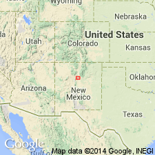
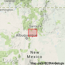
- Areal extent
- AAPG geologic province:
-
- Estancia basin
- San Juan basin
Summary:
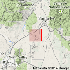
Fig. 2. Cuerbio basalt. Mapped in Galisteo-Tongue area, [Sandoval, Santa Fe, and Bernalillo Cos.], north-central NM. Age is Pleistocene. Younger than Santa Fe formation.
Source: US geologic names lexicon (USGS Bull. 1200, p. 1003).
- Usage in publication:
-
- Cuerbio basalt
- Modifications:
-
- Areal extent
- Dominant lithology:
-
- Basalt
- AAPG geologic province:
-
- San Juan basin
- Estancia basin
Summary:
Pg. 476, 477, pl. l. Cuerbio basalt. Basalt flows interbedded with Tuerto gravel (new) are tentatively correlated with Cuerbio basalt. [Age is Pleistocene(?).]
Source: US geologic names lexicon (USGS Bull. 1200, p. 1003).
- Usage in publication:
-
- Cuerbio basalt
- Modifications:
-
- Revised[?]
- AAPG geologic province:
-
- Estancia basin
Summary:
Pg. 5 (table 1), 29-30, pl. 1. Cuerbio basalt. [On geol. map (pl. 1) the Cuerbio is tentatively included in Santa Fe Group.] In this report [Cerrillos area, Santa Fe County, New Mexico], basalt flows that are interbedded with and overlie upper part of Ancha formation, together with an associated cinder cone, are placed in Cuerbio basalt. Two flows mapped; each about 20 feet thick. Age is Pleistocene(?).
Type locality and origin of name not stated. Name credited to Kirk Bryan (unpub. ms.).
Source: Publication; US geologic names lexicon (USGS Bull. 1200, p. 1003).
For more information, please contact Nancy Stamm, Geologic Names Committee Secretary.
Asterisk (*) indicates published by U.S. Geological Survey authors.
"No current usage" (†) implies that a name has been abandoned or has fallen into disuse. Former usage and, if known, replacement name given in parentheses ( ).
Slash (/) indicates name conflicts with nomenclatural guidelines (CSN, 1933; ACSN, 1961, 1970; NACSN, 1983, 2005, 2021). May be explained within brackets ([ ]).