- Usage in publication:
-
- Crystal Spring formation*
- Modifications:
-
- Original reference
- Dominant lithology:
-
- Quartzite
- Arkose
- Shale
- Limestone
- AAPG geologic province:
-
- Great Basin province
Summary:
Crystal Spring formation. Comprises about 2,000 feet of quartzite, arkose, shale, and limestone, intruded by sills of diorite and syenite, with beds of dolomite and chert at top and thick coarse conglomerate at base. Base of series [Pahrump series]; underlies Beck Spring dolomite (new); unconformably overlies Precambrian granite gneiss. Base of formation observed at only one locality, on west end of ridge 2 miles east of Horse Springs; here conglomeratic quartzite rests on Precambrian gneissic granite.
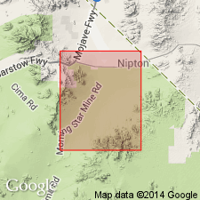
Crops out in belt that extends for 5 miles around north slope of Kingston Range and in two areas on eastern slope of range, Ivanpah quadrangle. Name derived from Crystal Spring on north slope of Kingston Range.
See also D.F. Hewett, 1940, Wash. Acad. Sci. Jour., v. 30, no. 6, p. 240; 1956, USGS Prof. Paper 275, p. 26, 28, 29, pl. 1.
Source: US geologic names lexicon (USGS Bull. 1200, p. 999).

- Usage in publication:
-
- Crystal Spring formation
- Modifications:
-
- Overview
- AAPG geologic province:
-
- Great Basin province
Summary:
Pg. 7 (fig. 3), 9-12, 13. Crystal Spring formation. Described in Superior talc area, Death Valley region, where it consists of lower 800 feet of conglomerate, quartzite, and shale, middle 600 feet of dolomite, and upper 200 feet of alternating quartzite, shale, and dolomite layers; a diabase sill, 200 to 600 feet thick, lies at or near the base of the massive dolomite; below sill is alternation zone which contains commercial talc deposit. Underlies Beck Spring dolomite; overlies Archean quartzite, gneiss, and schist.
Source: US geologic names lexicon (USGS Bull. 1200, p. 999-1000).
For more information, please contact Nancy Stamm, Geologic Names Committee Secretary.
Asterisk (*) indicates published by U.S. Geological Survey authors.
"No current usage" (†) implies that a name has been abandoned or has fallen into disuse. Former usage and, if known, replacement name given in parentheses ( ).
Slash (/) indicates name conflicts with nomenclatural guidelines (CSN, 1933; ACSN, 1961, 1970; NACSN, 1983, 2005, 2021). May be explained within brackets ([ ]).

