

- Usage in publication:
-
- Crow Mountain member
- Modifications:
-
- Named
- Dominant lithology:
-
- Sandstone
- Shale
- AAPG geologic province:
-
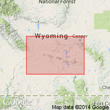
- Wind River basin
Summary:
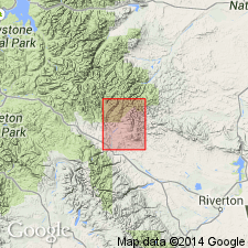
Named as a member of Chugwater formation for Crow Mountain near southeastern end of Washakie Range, Fremont Co, WY in Wind River basin. No type locality designated. Section measured in sec 36, T7N, R4W, sec 1, T6N, R4W, and sec 6, T6N, R3W, east side Red Creek, Fremont Co, in which 202 ft of predominantly white to gray, massive, cliff-forming sandstone is present. A thin purple shale present at top of measured section. Overlies Red Peak member (new). Unconformably? underlies Popo Agie member. Contrasts in color and hardness with overlying soft variegated clays and underlying bright red soft shales. Of Triassic age. No fossils were found. Geologic map.
Source: GNU records (USGS DDS-6; Denver GNULEX).
- Usage in publication:
-
- Crow Mountain Sandstone Member
- Modifications:
-
- Revised
- Overview
- AAPG geologic province:
-
- Wind River basin
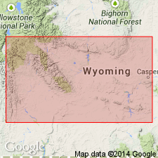
- Bighorn basin
Summary:
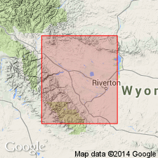
Revised in that unnamed red bed unit assigned to Chugwater Formation (revised); red bed unit occurs between Crow Mountain and Popo Agie (revised) Members of Chugwater. Study area within Wind River and Bighorn basins, WY on northeast flank of Wind River Mountains and north flank of Owl Creek Mountains. Assignment of red bed unit to Chugwater modifies lower boundary of Popo Agie and upper boundary of Crow Mountain. Lower part of unnamed red bed unit is in places a lateral facies of Crow Mountain; for this reason no formal name assigned to unit. Red bed unit ranges from 35-100 ft thick. In Hudson Dome (sec 24, T2S, R1E, Fremont Co) and Red Canyon (sec 36, T31N, R99W, Fremont Co) sections, Crow Mountain is not well developed and interval from base of Popo Agie to top of underlying Alcova Limestone Member of Chugwater could be assigned to unnamed red bed unit [thickness of interval not given]. Triassic age.
Source: GNU records (USGS DDS-6; Denver GNULEX).
- Usage in publication:
-
- Crow Mountain Sandstone Member
- Modifications:
-
- Age modified
- Overview
- Revised
- AAPG geologic province:
-
- Bighorn basin
- Wind River basin
Summary:
Study area is outcrops along line of section from about 9 mi south of Tensleep, Washakie Co, WY, Bighorn basin to about 8 mi north of Dubois, Fremont Co, WY, Wind River basin. Unit is third member from base of five members of Chugwater Formation. Crow Mountain is revised to include all rocks between Alcova Limestone Member of Chugwater (below) and unnamed redbed unit of Chugwater (above). Upper boundary is locally disconformable; Lower-Upper Triassic boundary is placed at disconformity at top of Crow Mountain. Early Triassic age of Crow Mountain based on work of Reeside (1929, Jour. Geology, v. 37, p. 58) who placed an unconformity at base of Popo Agie Member of Chugwater (which included at its base the unnamed redbed unit of this report) and believed that unconformity represented much of Middle Triassic and part of Late Triassic; also, in a previous study, Picard (1964, A.A.P.G. Bull., v. 48, p. 282, 284) detected changes in paleomagnetic directions and intensities at approximate position of upper boundary of Crow Mountain. Cross sections; petrographic data. Probable depositional environments of Crow Mountain are (ascending): 1) marine shelf and some eolian (basal sandstone unit); 2) tidal flat (upper sandstone and siltstone unit); and 3) beach (thin remnants in uppermost part of upper sandstone and siltstone unit). Climate during Crow Mountain time thought to be warm to hot and semi-arid to arid.
Source: GNU records (USGS DDS-6; Denver GNULEX).
- Usage in publication:
-
- Crow Mountain Formation
- Modifications:
-
- Revised
- Overview
- AAPG geologic province:
-
- Bighorn basin
Summary:
Raised to formation rank and assigned to Chugwater Group (rank raised) as middle of three formations in Bighorn basin, WY. Alcova Limestone Member (rank reduced) is assigned to Crow Mountain; Crow Mountain also subdivided into three informal units. In Hot Springs Co, Crow Mountain is well exposed along northern flank of Owl Creek Mountains, south of Thermopolis, where thickness is 83 ft along Buffalo Creek Road (sec 18, T42N, R92W); also well exposed north of Thermopolis (sec 30, T43N, R94W). In Washakie Co, unit is well exposed just north of Bigtrails (sec 7, T44N, R87W). Stratigraphic chart. Conformably overlies Red Peak Formation (rank raised) of Chugwater; disconformably underlies Popo Agie Formation (rank raised) of Chugwater. Early Triassic age.
Source: GNU records (USGS DDS-6; Denver GNULEX).
- Usage in publication:
-
- Crow Mountain Sandstone*
- Modifications:
-
- Revised
- AAPG geologic province:
-
- Wind River basin
- Green River basin
Summary:
Raised from member to formation rank and assigned to Chugwater Group (rank raised). Areal limit of use placed at the Granite Mountains of Fremont, Natrona, and Carbon Cos. Crow Mountain used to north and west. Term Jelm Formation, newly assigned to Chugwater Group, replaces Crow Mountain southeast of Granite Mountains. Recognized in Wind River basin southeast into Carbon Co in Greater Green River basin. Of Triassic age. Cross sections.
Source: GNU records (USGS DDS-6; Denver GNULEX).
- Usage in publication:
-
- Crow Mountain Formation
- Modifications:
-
- Revised
- Overview
- AAPG geologic province:
-
- Wind River basin
- Green River basin
Summary:
Throughout central WY Crow Mountain is disconformably overlain by Jelm Formation. Crow Mountain and Jelm are assigned to Chugwater Group. Crow Mountain divided into (ascending order): variegated sandy facies, Alcova Limestone Member (revised), "basal" sandstone unit, and upper sandstone and siltstone unit. East of Muddy Gap (sec 2, T27N, R89W, northwest Carbon Co, Greater Green River basin), upper two units of Crow Mountain grade laterally into basal Jelm; lower units assigned to Jelm. To west, upper units thin gradually between Hudson Dome (sec 19, T2S, R2E) and Dallas Dome (sec 13, T32N, R99W), both in Fremont Co, Wind River basin; units are absent at Red Mountain (secs 6, 7, T42N, R113W, Teton Co, Yellowstone province) and probably absent at Green River Lakes (sec 20, T39N, R108W and sec 36, T39N, R109W, Sublette Co, Greater Green River basin); lower units grade into upper part of Thaynes Formation in Red Mountain area. Overlies Red Peak Formation of Chugwater. Correlation chart; cross sections. Early Triassic age.
Source: GNU records (USGS DDS-6; Denver GNULEX).
- Usage in publication:
-
- Crow Mountain Sandstone*
- Modifications:
-
- Age modified
- Overview
- AAPG geologic province:
-
- Yellowstone province
- Green River basin
- Wind River basin
- Bighorn basin
- Powder River basin
Summary:
Within Yellowstone province, Greater Green River, Wind River, Big Horn, and Powder River basins of north-central WY, Lower-Upper Triassic boundary shown (cross section A-A' plate 1) to occur at Tr-2 unconformity which is at base of Crow Mountain, thus Crow Mountain is assigned Late Triassic age. Lower and upper parts of Crow Mountain are separated by Tr-3 unconformity which had a duration of less than 1 m.y. In south-central WY and adjacent parts of CO, lower part of Crow Mountain correlates with Red Draw Member of Jelm Formation; upper part of Crow Mountain correlates with Sips Creek Member of Jelm. Alcova Limestone which is beneath Crow Mountain and Tr-2 unconformity is shown only as Triassic. Underlies Popo Agie Formation.
Source: GNU records (USGS DDS-6; Denver GNULEX).
For more information, please contact Nancy Stamm, Geologic Names Committee Secretary.
Asterisk (*) indicates published by U.S. Geological Survey authors.
"No current usage" (†) implies that a name has been abandoned or has fallen into disuse. Former usage and, if known, replacement name given in parentheses ( ).
Slash (/) indicates name conflicts with nomenclatural guidelines (CSN, 1933; ACSN, 1961, 1970; NACSN, 1983, 2005, 2021). May be explained within brackets ([ ]).