The National Geologic Map Database is migrating to a new infrastructure. We apologize for any service disruptions during this process.
|
|---|


- Usage in publication:
-
- Croton gypsum
- Modifications:
-
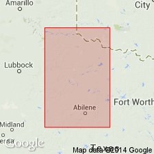
- Areal extent
- Dominant lithology:
-
- Gypsum
- AAPG geologic province:
-
- Permian basin
Summary:
Pl. 9. [Croton gypsum is shown as higher in section than Eskota dolomite and lower than Memphis sandstone, all of which are included in so-called Whitehorse-Cloud Chief formation. Is mapped in Stonewall County, central northern Texas. Origin of name not stated.] Age is Permian. Mapped in Stonewall County, central northern Texas.
See also "Tentative correlation of the named geologic units of Texas," compiled by M.G. Wilmarth, Secretary of Committee on Geologic Names, USGS unpub. corr. chart, Sept., 1930, sheet 3.
Source: US geologic names lexicon (USGS Bull. 896, p. 548).

- Usage in publication:
-
- Croton gypsum†
- Modifications:
-
- Abandoned
- AAPG geologic province:
-
- Permian basin
Summary:
Pg. 167. †Croton gypsum is same as Eskota gypsum and is discarded.
Source: US geologic names lexicon (USGS Bull. 896, p. 548).
For more information, please contact Nancy Stamm, Geologic Names Committee Secretary.
Asterisk (*) indicates published by U.S. Geological Survey authors.
"No current usage" (†) implies that a name has been abandoned or has fallen into disuse. Former usage and, if known, replacement name given in parentheses ( ).
Slash (/) indicates name conflicts with nomenclatural guidelines (CSN, 1933; ACSN, 1961, 1970; NACSN, 1983, 2005, 2021). May be explained within brackets ([ ]).