- Usage in publication:
-
- Cross Hill Member
- Modifications:
-
- Named
- Dominant lithology:
-
- Limestone
- Dolomite
- AAPG geologic province:
-
- Cincinnati arch
Summary:
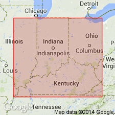
The Louisville Limestone at its type locality in north-central KY and in southern IN is here divided into three newly named members: Big Rock, Shanks Quarry, and Cross Hill. Cross Hill is equivalent to the Iron ledge of quarrymen terminology or unit No. 17 of Butts (1915). Iron ledge is here divided into upper and lower Iron ledges. The lower unit is approximately 5 ft thick and consists of cherty limestone; upper unit is also approximately 5 ft and consists of limestone, cherty limestone and limy dolomite. The Cross Hill is the least extensive of the three new members. It decreases in thickness toward the east and northeast, and disappears before reaching Prospect Hill in northeastern Jefferson Co. Only a small part of the unit is present in the Liter's Quarry, east of Sellersburg, Clark Co., IN. Unconformably underlies Jeffersonville Dolomite.
Source: GNU records (USGS DDS-6; Reston GNULEX).
For more information, please contact Nancy Stamm, Geologic Names Committee Secretary.
Asterisk (*) indicates published by U.S. Geological Survey authors.
"No current usage" (†) implies that a name has been abandoned or has fallen into disuse. Former usage and, if known, replacement name given in parentheses ( ).
Slash (/) indicates name conflicts with nomenclatural guidelines (CSN, 1933; ACSN, 1961, 1970; NACSN, 1983, 2005, 2021). May be explained within brackets ([ ]).

