

- Usage in publication:
-
- Crooked Creek formation
- Modifications:
-
- Original reference
- Biostratigraphic dating
- Dominant lithology:
-
- Sand
- Gravel
- Silt
- AAPG geologic province:
-
- Anadarko basin
Summary:
Pg. 69 (fig. 1), 70-73. Crooked Creek formation. Proposed for sediments laid down during cycle of deposition which followed Meade formation; includes the following succession (ascending): (1) sands and gravels, (2) silt, (3) Pearlette ash, and ( 4) overlying deposits up to and including a well-developed caliche; as thus defined, includes Stump Arroyo member (new) at base. Type locality for the Crooked Creek is the same locality that was designated by Frye and Hibbard (1941) as type locality of Meade formation; it is now known that beds to which Cragin (1896) applied name Meade formation do not occur in this sequence of Pleistocene deposits but belong to an older series of Pleistocene beds. [Includes Cudahy and Borchers faunas.]
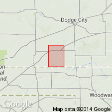
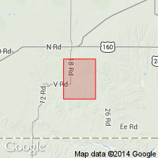
Type locality: in S/2 sec. 16, W/2 sec. 15, and N/2 sec. 21, T. 33 S., R. 28 W., [approx. Lat. 37 deg. 10 min. N., Long. 100 deg. 22 min. W., Irish Flats 7.5-min quadrangle], Meade Co., southwestern KS. Named from Crooked Creek, a tributary of the Cimarron River in Meade Co., southwestern KS.
Source: US geologic names lexicon (USGS Bull. 1200, p. 988); supplemental information from GNU records (USGS DDS-6; Denver GNULEX).
- Usage in publication:
-
- Crooked Creek formation
- Modifications:
-
- Revised
- AAPG geologic province:
-
- Anadarko basin
Summary:
Pg. 55 (fig. 1), 56, 57, 58. Crooked Creek formation. Top formation of Meade group. Comprises (ascending) Stump Arroyo member, Pearlette ash lentil, and Atwater member (new). Thickness as much as 60 feet. Overlies Ballard formation (new) of Meade group; underlies Kingsdown formation of Sanborn group. Age is Pleistocene.
Source: US geologic names lexicon (USGS Bull. 1200, p. 988).
- Usage in publication:
-
- Crooked Creek formation*
- Modifications:
-
- Areal extent
- AAPG geologic province:
-
- Anadarko basin
Summary:
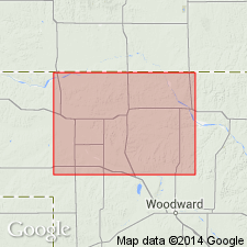
Pg. 57-58, pl. 2. Name Crooked Creek formation is applied in Harper County, northwestern Oklahoma, to gravels, sand, silt, and Pearlette volcanic ash lentils which unconformably overlie Ogalalla formation and Whitehorse group and are generally blanketed by post-Crooked Creek sand dune. Pearlette ash, which is only recognizable unit, forms a 13-foot lenticular bed in NW/4 sec. 10, T. 28 N., R. 26 W., but is absent elsewhere in county. Thickness 0 to 70 feet. [Age is Pleistocene.]
Source: US geologic names lexicon (USGS Bull. 1200, p. 988).
- Usage in publication:
-
- Crooked Creek Formation*
- Modifications:
-
- Geochronologic dating
- AAPG geologic province:
-
- Anadarko basin
Summary:
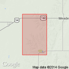
Sample collected from ash bed (considered Pearlette type O ash) within Crooked Creek Formation yielded fission-track age of about 0.6 Ma. Sample locality: in NW/4 NE/4 sec. 21, T. 33 S., R. 28 W., Meade Co., southwestern KS.
Source: Modified from GNU records (USGS DDS-6; Denver GNULEX).
- Usage in publication:
-
- Crooked Creek Formation
- Modifications:
-
- Age modified
- Biostratigraphic dating
- AAPG geologic province:
-
- Anadarko basin
Zakrzewski, R.J., 1975, Pleistocene stratigraphy and paleontology in western Kansas; The state of the art, 1974: University of Michigan, Museum of Paleontology Papers on Paleontology, no. 12., Claude W. Hibbard Memorial Volume, no. 3
Summary:
Pg. 122 (fig. 1), 124 (fig. 2), 125 (fig. 3), 126. Crooked Creek Formation. Divided into (descending) Atwater Silt Member and Stump Arroyo Gravel Member. Lies below Pearlette type O ash bed [Lava Creek B ash bed] and above Ballard Formation. Fossils (Borchers fauna, Seger local faunas). Age is Pliocene (Blancan NALMA); Pliocene-Pleistocene boundary placed at base of Irvingtonian NALMA (base of Nebraskan-Aftonian), = 1.8 Ma.
Source: Publication.
- Usage in publication:
-
- Crooked Creek Formation*
- Modifications:
-
- Revised
- Age modified
- Geochronologic dating
- Biostratigraphic dating
- Mapped 1:24k
- AAPG geologic province:
-
- Anadarko basin
Summary:
Crooked Creek Formation. Divided into upper unnamed member (Pliocene and Pleistocene) and Stump Arroyo Member (Pliocene). Overlies Rexroad Formation. Underlies Pleistocene basin-fill deposits (= Cragin's Jones Ranch beds, and Hibbard's Kingsdown and Vanhem formations). Age is Pliocene and Pleistocene, based on isotopic dating and fossils. [Pliocene-Pleistocene boundary placed at 1.8 Ma.]
Upper unnamed member, interbedded orange-gray silty sandstone and greenish-gray clayey sandstone, up to 25 m thick; lower part of member = type Atwater Member of Hibbard (1958). Includes Lava Creek B and Cerro Toledo B ash beds (Pleistocene), and Huckleberry Ridge ash bed (Pliocene). Vertebrate fossils indicate Blancan and Irvingtonian NALMA; carries Borchers fauna (Hibbard, 1941), Nash local fauna (Eshelman and HIbbard, 1981), Aries fauna, and Cudahy fauna (Hibbard, 1944).
Source: Publication.
- Usage in publication:
-
- Crooked Creek Formation*
- Modifications:
-
- Revised
- AAPG geologic province:
-
- Anadarko basin
Martin, R.A., Honey, J.G., and Pelaez-Camponanes, Pablo, 2000, The Meade basin [Kansas] rodent project; a progress report: Paludicola, v. 3, no. 1, p. 1-32.
Summary:
Crooked Creek Formation. Divided into (descending) Atwater Member and Stump Arroyo Member. Overlies Pliocene Ballard Formation. Underlies unnamed Pleistocene (Rancholabrean NALMA) and Recent deposits (= Kingsdown and Vanhem formations of Hibbard and Taylor, 1960, and Zakrzewski, 1975). Age is Pliocene and Pleistocene (Blancan and Irvingtonian NALMA), based on isotopic dating and fossils. [Pliocene-Pleistocene boundary placed at 1.8 Ma; = Blancan-Irvingtonian boundary.]
Source: Publication.
For more information, please contact Nancy Stamm, Geologic Names Committee Secretary.
Asterisk (*) indicates published by U.S. Geological Survey authors.
"No current usage" (†) implies that a name has been abandoned or has fallen into disuse. Former usage and, if known, replacement name given in parentheses ( ).
Slash (/) indicates name conflicts with nomenclatural guidelines (CSN, 1933; ACSN, 1961, 1970; NACSN, 1983, 2005, 2021). May be explained within brackets ([ ]).