

- Usage in publication:
-
- Crockett member
- Modifications:
-
- Principal reference
- Dominant lithology:
-
- Clay
- Sand
- AAPG geologic province:
-
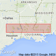
- East Texas basin
- Gulf Coast basin
Summary:
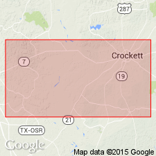
Pg. 1339-1346. Crockett member of Claiborne formation. Named proposed by E.A. Wendlandt and G.M. Knebel for that member of Claiborne formation in Texas which occurs below Milams member and above Sparta sand member. At type locality, in vicinity of Crockett, Houston County, eastern Texas, the Cockfield overlies the Crockett, overlapping the Saline Bayou and Milams members. A composite section extending from 1.8 miles, north of Crockett on Palestine road to 2.6 miles southwest of courthouse on Midway road, is as follows (descending): (1) calcareous, brownish gray, fossiliferous clay with zone of small ferruginous concretions, 15 feet; (2) brown, medium-fine sand, 2 feet; (3) grayish-brown clay with sand partings and a few ferruginous concretions, 14 feet; (4) brown clay, much weathered, 30 feet; (5) brown, sandy clay with streaks of laminated clay, much weathered, 30 feet; (6) ferruginous glauconitic sandstone, 1 foot; (7) gray sandy clay with streaks of weathered glauconitic sandstone, 10 feet; (8) gray, calcareous, fossiliferous clay and chocolate-brown carbonaceous clay with streaks of light-gray sand, 25 feet; (9) ferruginous sand, cross-bedded, and clay lumps, 5 feet; (10) grayish-brown clay with selenite, 30 feet. [Age is Eocene.]
Source: US geologic names lexicon (USGS Bull. 896, p. 545).
- Usage in publication:
-
- Crockett formation
- Modifications:
-
- Original reference
- Dominant lithology:
-
- Clay
- AAPG geologic province:
-
- East Texas basin
- Gulf Coast basin
Summary:
Pg. 1360-1361. Crockett formation. Chocolate brown and gray clay containing some beds of fossiliferous glauconite with concretionary zones of fossiliferous brown sandy limestone, some thin beds of sand, clay, ironstone concretions, and in places is calcareous. Thickness 350 to 450 feet. Underlies Milams member of Cook Mountain formation. Overlies Sparta sands. Where overlain by Yegua formation the contact is transitional and is usually selected where the last macro fossils appear. Well exposed southwest of Crockett, Houston County, eastern Texas. [Age is Eocene.]
Source: US geologic names lexicon (USGS Bull. 896, p. 545).

- Usage in publication:
-
- Crockett member
- Modifications:
-
- Overview
- AAPG geologic province:
-
- East Texas basin
- Gulf Coast basin
Summary:
Crockett member in Claiborne group. In eastern Texas (Houston and Sabine Counties), these beds are treated as a member of Cook Mountain formation by the USGS and in northwestern Louisiana as a member of St. Maurice formation. Age is Eocene.
[†St. Maurice formation later abandoned and replaced with Cane River Formation, Cook Mountain Formation, and Sparta Sand.]
Source: US geologic names lexicon (USGS Bull. 896, p. 545).

- Usage in publication:
-
- Crockett formation
- Modifications:
-
- Revised
- AAPG geologic province:
-
- East Texas basin
- Gulf Coast basin
Summary:
Pg. 612, 655+. Crockett formation. Underlies Cockfield formation, overlies Sparta formation, and includes Little Brazos limestone, Moseley limestone, and, at base, Eaton greensand lentil. [Age is Eocene.]
Source: US geologic names lexicon (USGS Bull. 896, p. 545).
- Usage in publication:
-
- Crockett formation
- Modifications:
-
- Revised
- AAPG geologic province:
-
- Gulf Coast basin
Summary:
Pg. 267-279. Restricted Crockett to the 100 feet of partly marine beds above Moseley limestone and named the 85 feet of underlying beds in Stone City section, Burleson County, eastern Texas, the Stone City beds. He included in his Stone City beds the Moseley limestone and Eaton greensand lentil of Renick, and stated that Crockett as restricted included a conglomerate at base which rested disconformably on Moseley limestone. [Age is Eocene.]
Source: US geologic names lexicon (USGS Bull. 896, p. 545).
- Usage in publication:
-
- Crockett formation
- Modifications:
-
- Revised
- AAPG geologic province:
-
- East Texas basin
Summary:
Pg. 20 (table), 124-158 [1938]. Crockett formation. Formation described in Leon County, eastern Texas, where it includes (ascending) Wheelock marl, Landrum shale, Spiller sand, and Mount Tabor members (all new). Overlies Stone City formation; underlies Yegua formation. Thickness about 385 feet. Age is middle Eocene.
Source: US geologic names lexicon (USGS Bull. 1200, p. 986-987).
- Usage in publication:
-
- Crockett formation
- Modifications:
-
- Revised
- AAPG geologic province:
-
- Gulf Coast basin
Summary:
Pg. 847-904 [1940]. Yegua-Crockett boundary discussed. [Age is Eocene.]
Source: US geologic names lexicon (USGS Bull. 1200, p. 986-987).
- Usage in publication:
-
- Crockett formation
- Modifications:
-
- Not used
- AAPG geologic province:
-
- East Texas basin
Summary:
Pg. 1663. Crockett formation replaced by term Cook Mountain formation.
Source: US geologic names lexicon (USGS Bull. 1200, p. 986-987).
- Usage in publication:
-
- Crockett formation
- Modifications:
-
- Areal extent
- AAPG geologic province:
-
- Gulf Coast basin
Harris, G.D., 1941, Report on the geology of Lee County, Texas: University of Texas-Austin, Bureau of Economic Geology Mineral Resources Circular, no. 33, 60 p.
Summary:
Pg. 13-20. In Leon County, eastern Texas, Crockett formaition includes (ascending) Stone City, Wheelock, Two Mile (new), and [Mount] Tabor members. [Age is Eocene.]
Source: US geologic names lexicon (USGS Bull. 1200, p. 986-987).
For more information, please contact Nancy Stamm, Geologic Names Committee Secretary.
Asterisk (*) indicates published by U.S. Geological Survey authors.
"No current usage" (†) implies that a name has been abandoned or has fallen into disuse. Former usage and, if known, replacement name given in parentheses ( ).
Slash (/) indicates name conflicts with nomenclatural guidelines (CSN, 1933; ACSN, 1961, 1970; NACSN, 1983, 2005, 2021). May be explained within brackets ([ ]).