

- Usage in publication:
-
- Crevasse Canyon formation
- Modifications:
-
- Named
- Dominant lithology:
-
- Shale
- Siltstone
- Coal
- AAPG geologic province:
-
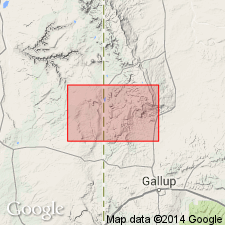
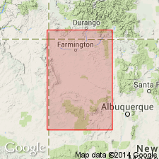
- San Juan basin
Summary:
Named as one of six formations of Upper Cretaceous Mesaverde group (raised to group rank in San Juan basin). Type locality established on north fork of Catron Creek, about 3 mi southwest of mouth of Crevasse Canyon, McKinley Co, NM in San Juan basin. Lies between Gallup sandstone and Point Lookout sandstone. Ranges from 420 to 620 ft thick in the northern part of area thickening south to about 700 ft at type. Divided into: Dilco member (composed of 240 ft of silty shale, laminated siltstone, thin coal, and thin- to medium-bedded fine-grained sandstone), Dalton sandstone member (composed of 60-117 ft coarse- to fine-grained, moderately to well-sorted quartz grains in a clay matrix, cementation variable, some feldspar grains in upper part), and lower Gibson member (composed of 135-500 ft gray, papery shale, carbonaceous shale, coal, shaly siltstone, and silty sandstone. Coal beds become more numerous southward). Assigned to Late Cretaceous.
Source: GNU records (USGS DDS-6; Denver GNULEX).
- Usage in publication:
-
- Crevasse Canyon formation*
- Modifications:
-
- Revised
- AAPG geologic province:
-
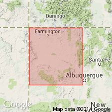
- San Juan basin
Summary:
Crevasse Canyon formation adopted as second formation from base of six formations assigned to Mesaverde group in San Juan basin. Term Mesaverde raised to group rank throughout San Juan basin of southwest CO and northwest NM. Generally overlies Gallup sandstone and underlies Point Lookout sandstone. Intertongues with Gallup, Point Lookout, and Mancos shale. Underlies Menefee formation in a small area near town of Gallup. Is divided into Dilco coal (base), Dalton sandstone, Bartlett barren, and Gibson coal (top) members, all formerly assigned to Mesaverde formation. Small geologic map. Diagrammatic cross section. Of Late Cretaceous age.
Source: GNU records (USGS DDS-6; Denver GNULEX).
- Usage in publication:
-
- Crevasse Canyon Formation
- Modifications:
-
- Revised
- AAPG geologic province:
-
- San Juan basin
Summary:
Crevasse Canyon Formation. Revised [in Crownpoint-Mount Taylor region, McKinley and Valencia Counties, northwestern New Mexico], to include Borrego Pass Lentil (new). [Age is considered Late Cretaceous.]
Source: Publication.
- Usage in publication:
-
- Crevasse Canyon Formation*
- Modifications:
-
- Biostratigraphic dating
- AAPG geologic province:
-
- San Juan basin
Summary:
Study of palynomorphs from samples of coals and shales of the Upper Cretaceous Crevasse Canyon Formation indicate a biostratigraphic age assignment of Coniacian and Santonian for the unit. Crevasse Canyon Formation, in the Hosta Butte area, McKinley Co, NM (San Juan basin), overlies Gallup Sandstone (Turonian) and is overlain by Hosta Tongue of the Point Lookout Sandstone (Santonian). Crevasse Canyon is separated into lower and upper parts by the Mulatto Tongue (Coniacian) of the Mancos Shale; lower part comprised of Dilco Coal Member (Coniacian) and upper part comprised of Dalton Sandstone Member (Coniacian) and Gibson Coal Member (Santonian). Turonian/Coniacian Stage boundary is queried at the Gallup/Dilco contact at base of Crevasse Canyon Formation. Coniacian/Santonian Stage boundary is queried at the Dalton/Gibson contact within the upper part of the Crevasse Canyon. Samples were examined from the Dilco and Gibson Members, but not the Dalton Member. Crevasse Canyon is tentatively divided into 3 pollen zones spanning the Coniacian and Santonian. The stage assignments are derived from invertebrate zone fossils found in the associated marine rocks. An uppermost Turonian ammonite is reported from near the top of the Gallup in the Gallup area. The Mulatto Tongue yields lower Coniacian INOCERAMUS DEFORMIS near Tohatchi. Thus the intervening Dilco is of Coniacian or possibly latest Turonian age. The Hosta Tongue of the Point Lookout Sandstone yields the middle Santonian ammonite CLIOSCAPHITES VERMIFORMIS. The Gibson Coal Member lies directly below the Hosta Tongue, consequently all the Gibson in the area is probably of Santonian age.
Source: GNU records (USGS DDS-6; Denver GNULEX).

- Usage in publication:
-
- Crevasse Canyon Formation
- Modifications:
-
- Areal extent
- AAPG geologic province:
-
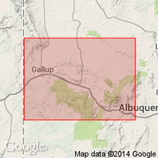
- San Juan basin
Summary:
About 25 mi northeast of Gallup, NM near Coal Mine Canyon, Hosta Tongue of Point Lookout pinches out. South of that locality, Gibson Coal Member of Crevasse Canyon Formation and Cleary Coal Member of Menefee Formation cannot be separated. [The stratigraphic restriction by Beaumont and others, 1956 of Gibson to only the lower part of what Sears in 1925 assigned to Gibson, and application of the name Cleary by Beaumont and others to the upper part of what Sears assigned to Gibson has set up a formation contact that cannot be mapped according to these authors.]
Source: GNU records (USGS DDS-6; Denver GNULEX).
- Usage in publication:
-
- Crevasse Canyon Formation*
- Modifications:
-
- Revised
- AAPG geologic province:
-
- San Juan basin
Summary:
Revised in that Torrivio Sandstone Member (redescribed) is removed from Gallup Sandstone and assigned to lower part of Crevasse Canyon. Torrivio is a fluvial sandstone unit that is genetically and lithologically very different from underlying marine tongues of Gallup. Torrivio is an irregularly bedded sandstone with variable grain size though is characteristically coarse grained and contains granules in lower part. The marine tongues of the Gallup are generally fine grained, very well sorted, and much more uniform in lateral extent. In addition "Coal" designation removed from Dilco Member of Crevasse Canyon because coal is a minor part of Dilco and in many areas to east within San Juan basin, coal is entirely absent. Relationships of underlying tongues of Gallup and Crevasse Canyon shown in fig. 2.
Source: GNU records (USGS DDS-6; Denver GNULEX).
For more information, please contact Nancy Stamm, Geologic Names Committee Secretary.
Asterisk (*) indicates published by U.S. Geological Survey authors.
"No current usage" (†) implies that a name has been abandoned or has fallen into disuse. Former usage and, if known, replacement name given in parentheses ( ).
Slash (/) indicates name conflicts with nomenclatural guidelines (CSN, 1933; ACSN, 1961, 1970; NACSN, 1983, 2005, 2021). May be explained within brackets ([ ]).