

- Usage in publication:
-
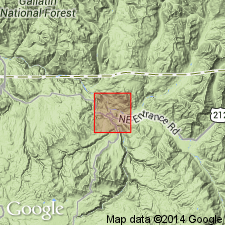
- Crescent Hill basalt
- Modifications:
-
- Named
- Dominant lithology:
-
- Basalt
- AAPG geologic province:
-
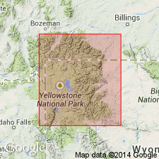
- Yellowstone province
Summary:
Named for typical exposures on summit of Crescent Hill (source of name), Yellowstone National Park, WY in the Yellowstone province. No type locality designated. Covers 4 or 5 sq mi between headwaters of Geode and Oxbow Creeks. Extends several mi west and north of type. Has a maximum thickness of 60 to 80 ft. Is a brown to gray, red or yellow, massive to platy, olivine basalt, though much of the olivine has changed to serpentine, and much of the pyroxene to uralite. Many of the fractures are healed with silica. Rests on breccia and on rhyolite. Is younger than Geode Creek basalt. Assigned to the Miocene-Pliocene. Geologic map.
Source: GNU records (USGS DDS-6; Denver GNULEX).
- Usage in publication:
-
- Crescent Hill Basalt*
- Modifications:
-
- Overview
- Areal extent
- AAPG geologic province:
-
- Yellowstone province
Summary:
Consists of two scoriaceous, partly pillowed trachybasalt flows that aggregate about 250 ft thick. Only lower flow present on Crescent Hill. Upper flow exposed on road between Oxbow and Geode Creeks, Yellowstone National Park, Yellowstone province, WY. The flows are represented by a northwestward-thinning tongue of Sepulcher Formation (new) of Washburn Group (new). Is restricted to north-central Yellowstone Park. Thought to be correlative with Mount Wallace Formation. Thought to be of early Bridgerian, middle Eocene age.
Source: GNU records (USGS DDS-6; Denver GNULEX).
For more information, please contact Nancy Stamm, Geologic Names Committee Secretary.
Asterisk (*) indicates published by U.S. Geological Survey authors.
"No current usage" (†) implies that a name has been abandoned or has fallen into disuse. Former usage and, if known, replacement name given in parentheses ( ).
Slash (/) indicates name conflicts with nomenclatural guidelines (CSN, 1933; ACSN, 1961, 1970; NACSN, 1983, 2005, 2021). May be explained within brackets ([ ]).