- Usage in publication:
-
- Creal Springs sandstone
- Modifications:
-
- Original reference
- Dominant lithology:
-
- Sandstone
- AAPG geologic province:
-
- Illinois basin
Summary:
Pg. 8 (fig. 2), 9. Creal Springs sandstone of Tradewater group. Sandstone overlying Upper New Burnside coal and immediately underlying Curlew limestone. Name credited to P.E. Potter (unpub. ms., 1957). Age is Pennsylvanian.
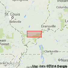
Exposed in vicinity of Creal Springs, in T. 10 S., R. 3 E. Johnson Co., southern IL.
Source: US geologic names lexicon (USGS Bull. 1200, p. 978).
For more information, please contact Nancy Stamm, Geologic Names Committee Secretary.
Asterisk (*) indicates published by U.S. Geological Survey authors.
"No current usage" (†) implies that a name has been abandoned or has fallen into disuse. Former usage and, if known, replacement name given in parentheses ( ).
Slash (/) indicates name conflicts with nomenclatural guidelines (CSN, 1933; ACSN, 1961, 1970; NACSN, 1983, 2005, 2021). May be explained within brackets ([ ]).

