The National Geologic Map Database is migrating to a new infrastructure. We apologize for any service disruptions during this process.
|
|---|


- Usage in publication:
-
- Craig limestone member*
- Modifications:
-
- First used
- Dominant lithology:
-
- Limestone
- AAPG geologic province:
-
- Appalachian basin
Summary:
Name appears on map legend.
Source: GNU records (USGS DDS-6; Reston GNULEX).
- Usage in publication:
-
- Craig limestone member*
- Modifications:
-
- Named
- Dominant lithology:
-
- Limestone
- AAPG geologic province:
-
- Appalachian basin
Summary:
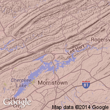
Named the Craig limestone member of the Rogersville shale for Craig quarry, Rutledge, Grainger Co., eastern TN. Member occurs near top of formation. Thickness at Craig quarry is 85 feet. The Craig is separated from the overlying Maryville limestone by 17 feet of green shale. Unit thins to west and northwest and thickens to east and southeast. A few miles east-northeast of Lee Valley section, overlying shale thins and eventually disappears and the Craig merges with the lithologically similar Maryville. The Craig is of Middle Cambrian age.
Source: GNU records (USGS DDS-6; Reston GNULEX).
- Usage in publication:
-
- Craig Limestone Member
- Modifications:
-
- Overview
- AAPG geologic province:
-
- Appalachian basin
Summary:
The Craig Limestone Member of the Rogersville Shale consists of dark-gray to olive-gray (weathers medium light gray to light gray), microcrystalline to cryptocrystalline, medium- to thick-bedded limestone. Thickness is 0 to 100 feet. Member occurs near top of formation and is separated from the overlying Maryville Limestone by shale.
Source: GNU records (USGS DDS-6; Reston GNULEX).
- Usage in publication:
-
- Craig Limestone Member
- Modifications:
-
- Overview
- AAPG geologic province:
-
- Appalachian basin
Summary:
The Craig Limestone Member of the Rogersville Shale ranges from 11 to 86 feet thick. West of Knoxville on Hunter Valley thrust sheet the Craig is not identified as its stratigraphic position is uncertain. Where the Rogersville disappears, the Craig Limestone Member merges with the lower part of the overlying Maryville Limestone.
Source: GNU records (USGS DDS-6; Reston GNULEX).
For more information, please contact Nancy Stamm, Geologic Names Committee Secretary.
Asterisk (*) indicates published by U.S. Geological Survey authors.
"No current usage" (†) implies that a name has been abandoned or has fallen into disuse. Former usage and, if known, replacement name given in parentheses ( ).
Slash (/) indicates name conflicts with nomenclatural guidelines (CSN, 1933; ACSN, 1961, 1970; NACSN, 1983, 2005, 2021). May be explained within brackets ([ ]).