- Usage in publication:
-
- Coyote Holes Formation
- Modifications:
-
- Named
- Dominant lithology:
-
- Conglomerate
- Fanglomerate
- AAPG geologic province:
-
- Great Basin province
Summary:
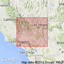
Named by McMackin (1987, Extensional tectonics of the Kingston Range and Mesquite Mountains: reinterpretation of the Winters Pass fault: unpublished Master's thesis, University of California at Davis, 109 p.). Name origin not stated. Type locality is area of exposures throughout Kingston Wash (as noted in generalized composite section of Neogene strata). Found also in northern Kingston Range, Mesquite Mountains, Shadow Mountains, Halloran Hills, and Alexander Hills, all in San Bernardino Co, east-central CA. Consists of boulder-and-cobble conglomerate, and locally, fanglomerate. In Kingston Wash, contains three separate fanglomerate facies: a southern facies shed from Shadow Mountain; an eastern facies shed from Mesquite Mountains, and a northern facies shed from Kingston Range. Coyote Holes strata are cut by normal faults to south and west of Kingston Range. Thickness varies from several tens of meters to minimum of >300 m south of Kingston Wash. Unconformably overlies late Miocene Evening Star Formation (new), as well as middle and late Miocene Resting Spring Formation of Hewett, 1956 (revised). Unconformably underlies Quaternary alluvium. Age is latest Miocene based, generally, on stratigraphic position and substantiated near the Alexander Hills by tuff dated at 8.4 m.y. (Calzia, personal comm., 1989). Report includes geologic sketch map and cross sections.
Source: GNU records (USGS DDS-6; Menlo GNULEX).
For more information, please contact Nancy Stamm, Geologic Names Committee Secretary.
Asterisk (*) indicates published by U.S. Geological Survey authors.
"No current usage" (†) implies that a name has been abandoned or has fallen into disuse. Former usage and, if known, replacement name given in parentheses ( ).
Slash (/) indicates name conflicts with nomenclatural guidelines (CSN, 1933; ACSN, 1961, 1970; NACSN, 1983, 2005, 2021). May be explained within brackets ([ ]).

