The National Geologic Map Database is migrating to a new infrastructure. We apologize for any service disruptions during this process.
|
|---|


- Usage in publication:
-
- Cotui Limestone*
- Modifications:
-
- Principal reference
- Revised
- AAPG geologic province:
-
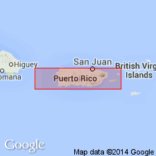
- Caribbean region
Summary:
The names San German Formation and its Cabo Rojo Agglomerate Member are here abandoned. The Cotui Limestone Member of the San German is here raised to formation rank as the Cotui Limestone. The rocks of the San German are assigned to the Cotui, the Lajas Formation, and the Sabana Grande Formation. The Cotui overlies the Lajas Formation with slight disconformity; conformably underlies the Sabana Grande Formation. Age is latest early Campanian through Maastrichtian. Brujo Limestone of Mattson (1960) is lithologically identical to and laterally continuous with the Cotui and is here abandoned; its rocks are assigned to the Cotui.
Type locality: exposures in Barrio Cotui along Road 314, 1.25 km south of Sabana Eneas, 350 m northeast and 150 m southwest of the intersection of Road 314 with an unnumbered road from the south.
Source: Modified from GNU records (USGS DDS-6; Reston GNULEX).

- Usage in publication:
-
- Cotui Limestone*
- Modifications:
-
- Overview
- AAPG geologic province:
-
- Caribbean region
Summary:
The Cotui Limestone occurs in southwestern Puerto Rico and consists of massive limestone with a local basal conglomerate containing clasts of lava from the underlying Lajas Formation. Maximum thickness is 75 meters. The Cotui is of Late Cretaceous age.
Source: GNU records (USGS DDS-6; Reston GNULEX).
For more information, please contact Nancy Stamm, Geologic Names Committee Secretary.
Asterisk (*) indicates published by U.S. Geological Survey authors.
"No current usage" (†) implies that a name has been abandoned or has fallen into disuse. Former usage and, if known, replacement name given in parentheses ( ).
Slash (/) indicates name conflicts with nomenclatural guidelines (CSN, 1933; ACSN, 1961, 1970; NACSN, 1983, 2005, 2021). May be explained within brackets ([ ]).