

- Usage in publication:
-
- Cottonwood Wash Formation
- Modifications:
-
- Named
- Dominant lithology:
-
- Conglomerate
- Tuff
- Limestone
- AAPG geologic province:
-
- Plateau sedimentary province
Summary:
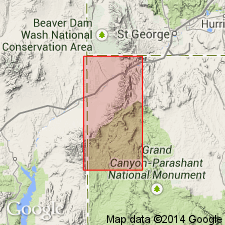
Named for wash where on west side unit is well exposed on ridge located approximately in unsurveyed sec 18, T37N, R15W, Mohave Co, AZ, Plateau sedimentary province. No type locality designated. Consists of well-indurated basal conglomerate overlain by poorly consolidated, water-lain tuff, and in upper part, limestone. Conglomerate consists of pebbles and cobbles of Paleozoic limestones within hard matrix of calcium carbonate cement and quartz sand. Maximum thickness of conglomerate is 50 feet between Lime Kiln mine and Jacobs Well where conglomerate is cliff forming; conglomerate thins to north and south and is not present north of Jacobs Well and southeast of Hungry Valley. Middle tuff member is thin and flat bedded and contains layers of bentonitic material; its maximum thickness is 600 feet. Upper limestone member is over 700 feet thick and is thin to medium bedded, fine grained, powdery and typically very vuggy and porous; weathers to gray or gray-buff color; forms hogback extending from near Hungry Valley northeast to west side of Sand Cove. Overlies Jacobs Ranch Formation (new) with angular unconformity; underlies Muddy Creek Formation with angular unconformity. Tentatively correlated with Overton Fanglomerate and Horse Spring Formation 40 mi to west in Muddy Mountains, NV and Claron Formation in Pine Valley Mountains near St George, UT. Stratigraphic chart. Assigned Late Cretaceous? or Eocene? age based on correlations.
Source: GNU records (USGS DDS-6; Denver GNULEX).
- Usage in publication:
-
- Cottonwood Wash Formation
- Modifications:
-
- Not used
Summary:
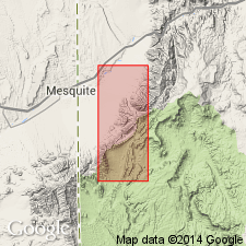
Exposed within 25 mi of Horse Spring, eastern Clark Co, NV. Is lithologically and stratigraphically similar to the Horse Spring Formation. Is considered to be equivalent to the lower half of the Horse Spring Formation of this report. Term Cottonwood Wash Formation not used.
Source: GNU records (USGS DDS-6; Denver GNULEX).
- Usage in publication:
-
- Cottonwood Wash Formation
- Modifications:
-
- Not used
Summary:
Not used in northwestern Mohave Co, AZ, Plateau sedimentary province. Rainbow Gardens Member of Horse Spring Formation used instead.
Source: GNU records (USGS DDS-6; Denver GNULEX).
For more information, please contact Nancy Stamm, Geologic Names Committee Secretary.
Asterisk (*) indicates published by U.S. Geological Survey authors.
"No current usage" (†) implies that a name has been abandoned or has fallen into disuse. Former usage and, if known, replacement name given in parentheses ( ).
Slash (/) indicates name conflicts with nomenclatural guidelines (CSN, 1933; ACSN, 1961, 1970; NACSN, 1983, 2005, 2021). May be explained within brackets ([ ]).