The National Geologic Map Database is migrating to a new infrastructure. We apologize for any service disruptions during this process.
|
|---|


- Usage in publication:
-
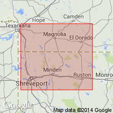
- Cotton Valley formation
- Modifications:
-
- Named
- Dominant lithology:
-
- Shale
- Sand
- Limestone
- AAPG geologic province:
-
- Gulf Coast basin
Summary:
Named the Cotton Valley formation for the Cotton Valley field, Webster parish, LA. Consists dominantly of marine beds, made up of various types of shale, sand, and limestone. Thickness is about 3240 feet. Overlies the Buckner formation and underlies the Travis formation. Unit includes the Schuler facies. The Cotton Valley is of Late Jurassic age.
Source: GNU records (USGS DDS-6; Reston GNULEX).
- Usage in publication:
-
- Cotton Valley formation
- Modifications:
-
- First used
- Dominant lithology:
-
- Sandstone
- Siltstone
- Shale
- AAPG geologic province:
-
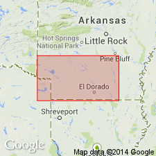
- Arkla basin
Summary:
First? published description. Named for the Cotton Valley field, Webster Parish, LA in Arkla basin. No type locality designated. Was referred to as the "Lower Marine beds" or as "Lower Travis Peak" in earlier reports. Unconformably overlies Buckner formation (first? used). Unconformably underlies Travis Peak formation. Occurs only as a subsurface unit in AR and LA. The thickest section penetrated is 2,275 ft in Union Co, AR. Thins northward. Marine phase recognized to south in LA. Rocks in the Schuler pool, Union Co, AR described: 1) basal 100 ft sand[stone] zone called the Jones sand; scattered pebbles occur at the base of the sand[stone] which is dense, calcareous, and shaly, upper part of the Jones is porous; the basal sand[stone] is succeeded upwards by 2) 20 ft of gray shale; 3) 490 ft of massive, fine to coarse, red sand[stone] with streaks of white sand[stone] containing black chert grains; 4) 970 ft of variegated red and gray shale interbedded with many streaks of silt[stone] and very fine to coarse white sand[stone]; 5) 570 ft of gray shale intercalated with red shale, some lenticular sands--one named Morgan sand zone; 6) 10-15 ft of gray-brown glauconitic fossiliferous shale; 7) 120 ft of interbedded sand[stone], siltstone, talc-like shale. Cross section, columnar section. Mesozoic age.
Source: GNU records (USGS DDS-6; Denver GNULEX).
- Usage in publication:
-
- Cotton Valley group
- Modifications:
-
- Revised
- AAPG geologic province:
-
- Gulf Coast basin
Summary:
Raised the rank of the Cotton Valley to the Cotton Valley group. Includes rocks between the base of the Hosston formation (Travis Peak formation of east Texas) and top of Buckner formation, or top of Smackover formation in areas where the Buckner is not recognizable. Consists of Bossier formation below and Schuler formation above.
Source: GNU records (USGS DDS-6; Reston GNULEX).
- Usage in publication:
-
- Cotton Valley Group
- Modifications:
-
- Revised
- AAPG geologic province:
-
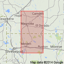
- Arkla basin
Summary:
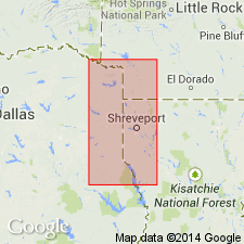
Two nomenclatures established for divisions of Cotton Valley Group. The updip section of southern AR can be separated into the Bossier Formation at the base, and the Schuler Formation at the top. The updip Schuler is restricted to the red bed nearshore facies. The Bossier can be recognized downdip. But the overlying part of the Cotton Valley down-dip is divided (ascending) into: Hico Shale, a gray shale; Terryville Sandstone, a massive white quartzose sandstone; and the Knowles Limestone, argillaceous limestone and gray shale. The three downdip formations in the upper part of the Cotton Valley are named in this report. The Terryville has five newly named northward pinching sandstone tongues--the Justiss, McFearin, Vaughn, Bodcaw, and Cadeville. The rocks assigned to the two nomenclatures intertongue in northern LA and southern AR. Cross sections. Study area lies in the Arkla basin. Cotton Valley overlies Buckner Formation and underlies Hosston Formation. Of Late Jurassic age.
Source: GNU records (USGS DDS-6; Denver GNULEX).
- Usage in publication:
-
- Cotton Valley Group*
- Modifications:
-
- Overview
- AAPG geologic province:
-
- Arkla basin
- East Texas basin
Summary:
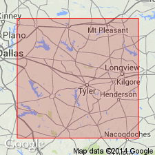
Divided into the Bossier and Schuler Formations. Overlies Buckner Formation at some localities, and lower member of Smackover Formation at other localities. Underlies Hosston Formation. Isopach maps, cross section, stratigraphic chart. Reference wells designated for Bossier and Schuler. Bossier revised to include a sequence above the Smackover that was assigned to the Buckner by Swain (1944), Smackover by Arper (1953) and marine equivalent of Buckner by Imlay (1943). Area of occurrence of formations of Cotton Valley Group is east TX, East Texas basin and adjoining southwest AR and northwest LA, Arkla basin. Of Late Jurassic age.
Source: GNU records (USGS DDS-6; Denver GNULEX).
- Usage in publication:
-
- Cotton Valley Group
- Modifications:
-
- Revised
- AAPG geologic province:
-
- East Texas basin
Summary:
Divided into Bossier Formation (Upper Jurassic) at base and Schuler Formation (Upper Jurassic and Lower Cretaceous) at top. Revised in that Bossier unconformably overlies the newly named Gilmer Limestone, upper formation of Louark Group in northeast TX, East Texas basin. Areal extent map of Gilmer. Rocks assigned to Gilmer were called "Cotton Valley limestone" or "Haynesville limestone" in earlier reports. Schuler is overlain by the Hosston Formation. E-log cross section. Correlation chart.
Source: GNU records (USGS DDS-6; Denver GNULEX).
- Usage in publication:
-
- Cotton Valley Group
- Modifications:
-
- Overview
- AAPG geologic province:
-
- South Georgia sedimentary province
Summary:
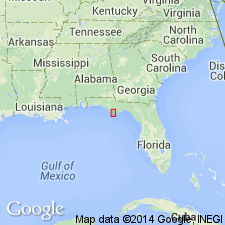
The Cotton Valley Group in panhandle FL overlies the Haynesville Formation and consists of a thick sequence of varicolored lignitic mudstones and coarse sandstones. Color typically ranges from red to purple to brown, and sometimes green. In Gulf Co., the unit varies from about 1,800 to 2,600 ft thick, but is undivided as in other states. Generally thickens to the southwest (basin-ward). The Cotton Valley underlies unnamed Lower Cretaceous reddish and reddish-brown interbedded shales and sandstones that in turn underlie the Atkinson Formation. Age of the Cotton Valley is Late Jurassic.
Source: GNU records (USGS DDS-6; Reston GNULEX).
- Usage in publication:
-
- Cotton Valley Formation
- Modifications:
-
- Overview
- AAPG geologic province:
-
- Mid-Gulf Coast basin
GNU Staff, 1994, GNU Staff remark by E.D. Koozmin. Cotton Valley Group/Formation.: U.S. Geological Survey Digital Data Series, DDS-6, 1 CD-ROM., release 3
Summary:
In Mississippi, Alabama, and Florida, Cotton Valley should be used at formation rank only. Non-USGS workers have indiscriminately carried the term Cotton Valley Group from Louisiana further east, but have either not subdivided it, or have cited it as being composed only of Schuler Formation. USGS-authored report by Eargle (1964, Prof. Paper 475-D, p. D43-D48) states that Cotton Valley is used as a formation instead of a group in Mississippi because the group's formations cannot be differentiated. USGS-authored report by Imlay (1980, Prof. Paper 1062), shows ambiguous usage in Alabama. USGS-authored report by J.A. Miller (1982, AAPG Bull., v. 26, 66, no. 9, p. 1289-1301) extended Cotton Valley Group into Florida, but it was not subdivided; USGS usage at group rank should be discontinued in Florida; can be used as Cotton Valley Formation.
Source: GNU records (USGS DDS-6; Reston GNULEX).
For more information, please contact Nancy Stamm, Geologic Names Committee Secretary.
Asterisk (*) indicates published by U.S. Geological Survey authors.
"No current usage" (†) implies that a name has been abandoned or has fallen into disuse. Former usage and, if known, replacement name given in parentheses ( ).
Slash (/) indicates name conflicts with nomenclatural guidelines (CSN, 1933; ACSN, 1961, 1970; NACSN, 1983, 2005, 2021). May be explained within brackets ([ ]).