The National Geologic Map Database is migrating to a new infrastructure. We apologize for any service disruptions during this process.
|
|---|


- Usage in publication:
-
- Cotorra Tuff*
- Modifications:
-
- Named
- Dominant lithology:
-
- Tuff
- Breccia
- AAPG geologic province:
-
- Caribbean region
Summary:
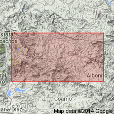
The Cotorra Tuff, here named, consists of massive, basaltic, dark-green to bluish-black crystal-vitric tuff and tuff breccia. Rests on Malo Breccia and may be contemporaneous with upper part of the Malo; conformably underlies volcanic conglomerate that is a lateral equivalent of the Cariblanco Formation. Thickness ranges from 0 to 500 m, thins to the north suggesting that it was obstructed by the Malo. Marine origin suggested by presence of pillows. Age is Late Cretaceous (Santonian) based on correlation with the Malo and Robles.
Source: GNU records (USGS DDS-6; Reston GNULEX).

- Usage in publication:
-
- Cotorra Tuff*
- Modifications:
-
- Overview
- AAPG geologic province:
-
- Caribbean region
Summary:
The Cotorra Tuff occurs in central Puerto Rico and consists of basaltic hyaloclastite-breccia with pillowed basalt flows at the base and top. Maximum estimated thickness is 500 meters. The Cotorra is of Late(?) Cretaceous age.
Source: GNU records (USGS DDS-6; Reston GNULEX).
For more information, please contact Nancy Stamm, Geologic Names Committee Secretary.
Asterisk (*) indicates published by U.S. Geological Survey authors.
"No current usage" (†) implies that a name has been abandoned or has fallen into disuse. Former usage and, if known, replacement name given in parentheses ( ).
Slash (/) indicates name conflicts with nomenclatural guidelines (CSN, 1933; ACSN, 1961, 1970; NACSN, 1983, 2005, 2021). May be explained within brackets ([ ]).