The National Geologic Map Database is migrating to a new infrastructure. We apologize for any service disruptions during this process.
|
|---|


- Usage in publication:
-
- Corough sandstone member
- Modifications:
-
- Original reference
- Dominant lithology:
-
- Sandstone
- AAPG geologic province:
-
- Gulf Coast basin
Summary:
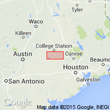
Pg. 68, fig. 3. Corough sandstone member of Catahoula formation. Name applied to sandstone occurring roughly 175 feet above base of Catahoula. Thickness 0 to 40 feet. Age is Micoene(?).
Type locality: where a road crosses member about 2.5 mi west-southwest of Erwin, Grimes Co., east-central TX. Named from land survey at type locality.
Source: US geologic names lexicon (USGS Bull. 1200, p. 945).
For more information, please contact Nancy Stamm, Geologic Names Committee Secretary.
Asterisk (*) indicates published by U.S. Geological Survey authors.
"No current usage" (†) implies that a name has been abandoned or has fallen into disuse. Former usage and, if known, replacement name given in parentheses ( ).
Slash (/) indicates name conflicts with nomenclatural guidelines (CSN, 1933; ACSN, 1961, 1970; NACSN, 1983, 2005, 2021). May be explained within brackets ([ ]).