- Usage in publication:
-
- Corduroy Member
- Modifications:
-
- Named
- Dominant lithology:
-
- Mudstone
- Siltstone
- Claystone
- Limestone
- Gypsum
- AAPG geologic province:
-
- Black Mesa basin
- Basin-and-Range province
Summary:
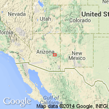
Named as the upper member (of 4) of Supai Formation for Corduroy Creek west of U.S. Hwy 60 about 15 mi east of village of Cibecue, sec 3, T8N, R20E, Navajo Co, AZ, in the Black Mesa basin. No type locality designated. Overlies Fort Apache Limestone Member of Supai. Underlies Coconino Sandstone. Forms series of terraced slopes and ledges. The red beds underlie the slopes. Limestone and gypsum make up the ledges. Consists of 370 ft of red-brown, slightly calcareous to calcareous mudstone, siltstone, and claystone, gray poorly fossiliferous limestone, and one 15 ft thick bed of gypsum. Probably deposited marginal to an oscillating sea. Measured sections described in Navajo and in adjoining Gila Co, AZ (Basin-and-Range province). Correlation chart. Of Early Permian, Leonardian age.
Source: GNU records (USGS DDS-6; Denver GNULEX).

- Usage in publication:
-
- Corduroy Member
- Modifications:
-
- Revised
- AAPG geologic province:
-
- Basin-and-Range province
Summary:
Reassigned from the Supai Formation, a term replaced by the newly named Schnebly Hill Formation, in central AZ, Basin-and-Range province, to the Schnebly Hill as its upper member in the eastern sections (Bell Rock to Carrizo Creek). Is similar to the Big A Butte Member of the Schnebly Hill which is also reassigned from the Supai to the Schnebly Hill. Consists of siltstone, mudstone, gypsum and carbonate. Is dominantly halite and other evaporites in the Holbrook basin. Thins westward, tonguing into the Sycamore Pass Member (also newly named) of the Schnebly Hill. Not recognized west of Fossil Creek. Is 370 ft thick at its type section. Cross sections. Nomenclature chart. Of Early Permian, Leonardian age.
Source: GNU records (USGS DDS-6; Denver GNULEX).
For more information, please contact Nancy Stamm, Geologic Names Committee Secretary.
Asterisk (*) indicates published by U.S. Geological Survey authors.
"No current usage" (†) implies that a name has been abandoned or has fallen into disuse. Former usage and, if known, replacement name given in parentheses ( ).
Slash (/) indicates name conflicts with nomenclatural guidelines (CSN, 1933; ACSN, 1961, 1970; NACSN, 1983, 2005, 2021). May be explained within brackets ([ ]).

