The National Geologic Map Database is migrating to a new infrastructure. We apologize for any service disruptions during this process.
|
|---|


- Usage in publication:
-
- Corcoran member
- Modifications:
-
- Named
- Dominant lithology:
-
- Sandstone
- Coal
- AAPG geologic province:
-
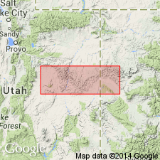
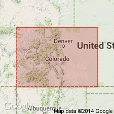
- Piceance basin
Summary:
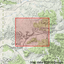
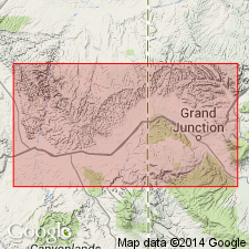
Named for exposures near the old Corcoran mine north of Palisade, Mesa Co, CO in the Piceance basin. No type locality designated. Placed in the Neslen facies (formerly Neslen member), the coal-bearing facies of the Price River formation, and is one of five members assigned to the Price River. Consists of "littoral marine sandstone and coal-bearing rocks." Gradationally overlies either Mancos shale or Sego member of Price River, depending on locality. Averages 100 ft thick. Includes the Palisade coal which is traceable from Big Salt Wash to Plateau Creek. Four [coal?] beds can be traced eastward to Grand Mesa, CO. [Westward extent not clearly stated.] Of Montana, Late Cretaceous age.
Source: GNU records (USGS DDS-6; Denver GNULEX).
- Usage in publication:
-
- Corcoran Member
- Modifications:
-
- Revised
- Areal extent
- Overview
- Age modified
- AAPG geologic province:
-
- Piceance basin
Summary:
Reassigned to Mesaverde Formation (revised) in southern Piceance basin and to Iles Formation (revised) of Mesaverde Group in northeast Piceance basin, western CO. Fig. 2 is an electric log correlation across southern Piceance basin from surface section at Hunter Canyon, Mesa Co, east to surface section at South Canyon Creek, Garfield Co. Corcoran is recognized a few mi east of UT-CO border. Unit is about 100 ft thick at Hunter Canyon and can be traced across southern Piceance basin to outcrop at South Canyon Creek where it consists of two massive-bedded 12-15-ft sandstones and other thin-bedded sandstones. Fig. 3 is correlation of measured sections along Grand Hogback from North Thompson Creek, Pitkin Co, Eagle basin, northward to White River, Rio Blanco Co, Piceance basin. Corcoran is recognizable from South Canyon Creek north to Rifle Gap. Its extent south of South Canyon Creek and its presence at Piceance Creek (north of Rifle Gap) is uncertain. North of Piceance Creek, at White River section, in northeast Piceance basin, Corcoran is present and assigned to nonmarine part of Iles Formation. Separated from underlying Sego Member (revised) of Mesaverde and from overlying Cozzette Member (revised) of Mesaverde and Iles by marine tongues of Mancos Shale. Fossils are within BACULITES SCOTTI and DIDYMOCERAS NEBRASCENSE faunal zones suggesting Campanian (Late Cretaceous) age.
Source: GNU records (USGS DDS-6; Denver GNULEX).
- Usage in publication:
-
- Corcoran Sandstone Member
- Modifications:
-
- Areal extent
- Overview
- AAPG geologic province:
-
- Piceance basin
Summary:
Assigned to Iles Formation (revised) of Mesaverde Group. Plate 2 is cross section of measured sections along Grand Hogback, western CO, from Coal Basin area, Pitkin Co, Eagle basin, north to White River, near Meeker, Rio Blanco Co, Piceance basin (Mancos Shale and Iles parts of sections are taken from Warner (1964)). Corcoran occurs at least as far north as Rifle Gap and can be traced south along hogback to between South Canon and Four Mile Creek, Piceance basin, where it pinches out. Corcoran is basal sandstone of Iles from south of Harvey Gap (where underlying Sego? Sandstone Member (revised) of Iles pinches out) to where it pinches out south of South Canyon. Thickness in area of Harvey Gap is 130 ft. Tongues of Mancos intervene between underlying Sego? and overlying Cozzette Sandstone Member of Iles. Significant coal occurs within unit at Rifle Gap and at Harvey Gap. Chart comparing nomenclature of previous workers. Late Cretaceous age.
Source: GNU records (USGS DDS-6; Denver GNULEX).
- Usage in publication:
-
- Corcoran Sandstone Member*
- Modifications:
-
- Revised
- Areal extent
- AAPG geologic province:
-
- Piceance basin
Summary:
Reassigned as basal sandstone member of Mount Garfield Formation in CO. Intertongues with underlying Sego Sandstone and overlying Cozzette Sandstone Member of Mount Garfield. May intertongue with, underlie and overlie tongues of Mancos Shale also. Has a maximum thickness of about 120 ft. Western extent is about 2 mi west of Hunter Canyon, T9S, R100W, Mesa Co, CO in Piceance basin. Eastern pinchout into Mancos Shale is about 6.5 mi east of Watson Creek, sec 25, T11S, R98W, Mesa Co. Mapped in subsurface in Ts7-9S, Rs98-100W, Mesa and Garfield Cos on cross section. Correlation diagram. Measured sections. Of Late Cretaceous age.
Source: GNU records (USGS DDS-6; Denver GNULEX).
For more information, please contact Nancy Stamm, Geologic Names Committee Secretary.
Asterisk (*) indicates published by U.S. Geological Survey authors.
"No current usage" (†) implies that a name has been abandoned or has fallen into disuse. Former usage and, if known, replacement name given in parentheses ( ).
Slash (/) indicates name conflicts with nomenclatural guidelines (CSN, 1933; ACSN, 1961, 1970; NACSN, 1983, 2005, 2021). May be explained within brackets ([ ]).