The National Geologic Map Database is migrating to a new infrastructure. We apologize for any service disruptions during this process.
|
|---|


- Usage in publication:
-
- Copper Lake Formation*
- Modifications:
-
- Named
- Dominant lithology:
-
- Conglomerate
- Sandstone
- Siltstone
- AAPG geologic province:
-
- Alaska Peninsula province
- Alaska Southwestern region
Summary:
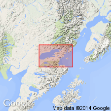
Type section: composite of type sections of members: lower conglomerate member: east end of ridge 2.5 km S 45 deg E of outlet of Upper Copper Lake; sandstone and siltstone member: eastern slope of peak 2432, 1.6 km south of west end of Boot Lake; upper conglomerate member: ravine cutting eastern face of ridge between Fog and Kakhonak Lakes; all between Upper Copper Lake and Sid Larson Bay, southeast of Lake Iliamna, Iliamna quad, Alaska Peninsula, AK. Consists of gray conglomerate, sandstone, and siltstone. Lower conglomerate member is 91 m thick, sandstone and siltstone member, 503 m, and upper conglomerate member 975 m. Nonconformably overlies Middle Jurassic quartz diorite pluton or unconformably overlies Kakhonak Complex (new); unconformably underlies Tertiary volcanic rocks. Is Paleocene(?) and Eocene age.
Source: GNU records (USGS DDS-6; Menlo GNULEX).
- Usage in publication:
-
- Copper Lake Formation*
- Modifications:
-
- Areal extent
- AAPG geologic province:
-
- Alaska Peninsula province
- Alaska Southwestern region
Summary:
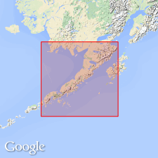
Copper Lake Formation. Unit geographically extended into Cape Douglas area (at expense of West Foreland Formation) based on lithology. Age here is Paleocene(?) and early Eocene.
Source: GNU records (USGS DDS-6; Menlo GNULEX).
For more information, please contact Nancy Stamm, Geologic Names Committee Secretary.
Asterisk (*) indicates published by U.S. Geological Survey authors.
"No current usage" (†) implies that a name has been abandoned or has fallen into disuse. Former usage and, if known, replacement name given in parentheses ( ).
Slash (/) indicates name conflicts with nomenclatural guidelines (CSN, 1933; ACSN, 1961, 1970; NACSN, 1983, 2005, 2021). May be explained within brackets ([ ]).