The National Geologic Map Database is migrating to a new infrastructure. We apologize for any service disruptions during this process.
|
|---|


- Usage in publication:
-
- Copper King Shale
- Modifications:
-
- Named
- Dominant lithology:
-
- Shale
- AAPG geologic province:
-
- Great Basin province
Summary:
Pg. 12 (table 2), footnote. E.C. Stephens (1946, unpub. rept.) gave a stratigraphic section of the Mountain City quadrangle. Copper King Shale, 540 feet thick, consists of black and gray shale. Overlies Copper Mountain Quartzite and underlies Black Rock Quartzite. Nolan (1937, USGS open-file rept.) proposed section that differed from Stephens' section in several ways. He grouped the Rio Tinto Formation, Black Rock Quartzite, and Copper King Shale together as Rio Tinto Formation. The Copper Mountain quartzite was believed to have been thrust over the Copper King Shale. Age is Paleozoic.
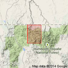
["Type area"] is near Rio Tinto Mine in Mountain City quadrangle, Elko Co., northern NV.
Source: US geologic names lexicon (USGS Bull. 1350, p. 173); GNC index card files (USGS-Menlo).
For more information, please contact Nancy Stamm, Geologic Names Committee Secretary.
Asterisk (*) indicates published by U.S. Geological Survey authors.
"No current usage" (†) implies that a name has been abandoned or has fallen into disuse. Former usage and, if known, replacement name given in parentheses ( ).
Slash (/) indicates name conflicts with nomenclatural guidelines (CSN, 1933; ACSN, 1961, 1970; NACSN, 1983, 2005, 2021). May be explained within brackets ([ ]).