

- Usage in publication:
-
- Copper Harbor conglomerates
- Modifications:
-
- Named
- Dominant lithology:
-
- Conglomerate
- Volcanics
- AAPG geologic province:
-
- Wisconsin arch
Summary:
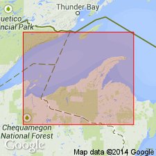
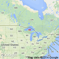
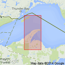
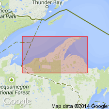
Named for exposures around Copper Harbor, Keweenaw Co., northern MI. Includes rocks previously mapped as Greater conglomerate, Outer conglomerate, and Lake Shore traps (interbedded flows) around Copper Harbor where contacts between those units cannot be drawn consistently. Copper Harbor conglomerates is a local term used for the whole assemblage and includes the Lake Shore traps as a lentil or lentils. Thickness ranges from 1,740 to 7,500 ft. Underlies Nonesuch shale; overlies Eagle River group. Age is Precambrian (Keweenawan).
Source: GNU records (USGS DDS-6; Reston GNULEX).
- Usage in publication:
-
- Copper Harbor group*
- Modifications:
-
- Revised
- AAPG geologic province:
-
- Wisconsin arch
Summary:
Copper Harbor revised as group to include (ascending) Great conglomerate, Lake Shore traps, and Outer conglomerate.
Source: GNU records (USGS DDS-6; Reston GNULEX).
- Usage in publication:
-
- Copper Harbor conglomerate*
- Modifications:
-
- Revised
- Overview
- AAPG geologic province:
-
- Wisconsin arch
Summary:
Revised as Copper Harbor conglomerate. Conformably overlies Portage Lake lava series (new). Consists of rudely stratified pebble to boulder conglomerate and subordinate amounts of sandstone. Pebble and boulders are red to brown, well rounded to subangular and composed primarily of rhyolite. Also contains small amounts of amygdaloidal or massive basalt as can be seen in roadcuts that expose top of formation in sec. 27, T57N, R33W. Matrix of conglomerate is coarse sand grit of same lithologic character as coarser material. Three mafic lava flows are included in formation and are separately mapped. Age is Precambrian (upper Keweenawan).
Source: GNU records (USGS DDS-6; Reston GNULEX).
- Usage in publication:
-
- Copper Harbor Conglomerate*
- Modifications:
-
- Revised
- AAPG geologic province:
-
- Wisconsin arch
Summary:
Table 2 in report shows Oronto Group as including Freda Sandstone, Nonesuch Shale, and Copper Harbor Conglomerate.
Source: GNU records (USGS DDS-6; Reston GNULEX).
- Usage in publication:
-
- Copper Harbor Conglomerate*
- Modifications:
-
- Revised
- Age modified
- AAPG geologic province:
-
- Wisconsin arch
Summary:
Copper Harbor Conglomerate removed from Oronto Group. Age changed from upper Keweenawan to middle Keweenawan. Oronto Group now consists of just Freda Sandstone and underlying Nonesuch Shale. Top of Copper Harbor is adopted as base of upper Keweenawan and of the Oronto Group. Copper Harbor is a better boundary between upper and middle Keweenawan than other stratigraphic horizons that have been used inconsistently from place to place. Irving's (1883) boundary cannot be traced farther away from Keweenaw Peninsula. Top of Copper Harbor comes closer to marking end of Keweenawan volcanism than other boundaries. In addition, no other major stratigraphic boundary in the Keweenawan province is so precisely located over so large a fraction of its total outcrop trace. Author notes that upper Keweenawan time is part of Precambrian Y, an interim subdivision of Precambrian time. Precambrian Y spans the period between 1,600 and 800 m.y.
Source: GNU records (USGS DDS-6; Reston GNULEX).
- Usage in publication:
-
- Copper Harbor Conglomerate*
- Modifications:
-
- Revised
- AAPG geologic province:
-
- Wisconsin arch
Summary:
Copper Harbor Conglomerate assigned to Keweenawan Supergroup of middle Keweenawan age (Precambrian Y).
Source: GNU records (USGS DDS-6; Reston GNULEX).
- Usage in publication:
-
- Copper Harbor Conglomerate*
- Modifications:
-
- Overview
- AAPG geologic province:
-
- Lake Superior region
Summary:
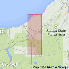
Mapped as part of middle Keweenawan rocks of Keweenawan Supergroup on Iron River 1 x 2 degree quad, northwest MI in Lake Superior region. Interbedded with volcanic flows and minor interflow sedimentary rocks of the unnamed formation of White (1972). Underlies Nonesuch Shale and overlies Portage Lake Volcanics. Is Middle Proterozoic in age.
Source: GNU records (USGS DDS-6; Denver GNULEX).
- Usage in publication:
-
- Copper Harbor Conglomerate
- Modifications:
-
- Revised
- Age modified
- AAPG geologic province:
-
- Wisconsin arch
Summary:
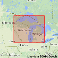
Copper Harbor Conglomerate reassigned as basal unit of Oronto Group within WI. Age modified as Early and Middle Proterozoic.
Source: GNU records (USGS DDS-6; Reston GNULEX).
- Usage in publication:
-
- Copper Harbor Conglomerate
- Modifications:
-
- Geochronologic dating
- AAPG geologic province:
-
- Lake Superior region
Summary:
U-Pb dates on three zircon fractions within Lake Shore Trap give an age of 1087.2 +/-1.6 Ma (68% probability of fit). Lake Shore is an andesite flow within Copper Harbor Conglomerate. Study area is on Keweenawan Peninsula, MI, Lake Superior region.
Source: GNU records (USGS DDS-6; Denver GNULEX).
- Usage in publication:
-
- Copper Harbor Conglomerate
- Modifications:
-
- Overview
- AAPG geologic province:
-
- Wisconsin arch
Summary:
The middle portion of the Copper Harbor includes a succession of 31 lava flows with a maximum thickness of 600 m known as the Lake Shore traps (Lane, 1911). Composition of the Lake Shore ranges from Fe-rich olivine tholeiites at the base to Fe-rich olivine-bearing tholeiitic basaltic andesites to tholeiitic andesites at the top according to Paces and Bornhorst (1985). U-Pb age on zircon for the Lake Shore reported by Davis and Paces (1990) is 1094+/-3.6 Ma.
Source: GNU records (USGS DDS-6; Reston GNULEX).
- Usage in publication:
-
- Copper Harbor Conglomerate*
- Modifications:
-
- Revised
- AAPG geologic province:
-
- Wisconsin arch
Summary:
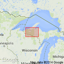
Copper Harbor Conglomerate assigned to Oronto Group, reverting to pre-1972 usage. White (1972) removed Copper Harbor from Oronto Group because the basal contact of the Copper Harbor was ambiguous and did not provide a good lower contact for the Oronto Group. Although this usage was adopted by the USGS, other workers have continued to include the Copper Harbor in the Oronto Group. In addition, mapping since 1972 has not revealed the difficulties in correlating the group boundary that White (1972) predicted as a major problem. The Copper Harbor rocks are more akin to the Freda Sandstone and Nonesuch Shale in its mostly sedimentary nature, although its lower part records the transition from a dominantly volcanic regime to a dominantly sedimentary regime. Age is Middle Proterozoic. Report includes geologic map and correlation chart.
Source: GNU records (USGS DDS-6; Reston GNULEX).
For more information, please contact Nancy Stamm, Geologic Names Committee Secretary.
Asterisk (*) indicates published by U.S. Geological Survey authors.
"No current usage" (†) implies that a name has been abandoned or has fallen into disuse. Former usage and, if known, replacement name given in parentheses ( ).
Slash (/) indicates name conflicts with nomenclatural guidelines (CSN, 1933; ACSN, 1961, 1970; NACSN, 1983, 2005, 2021). May be explained within brackets ([ ]).