- Usage in publication:
-
- Copper Creek Conglomerate
- Modifications:
-
- Named
- Dominant lithology:
-
- Conglomerate
- AAPG geologic province:
-
- Northern Rocky Mountain region
Summary:
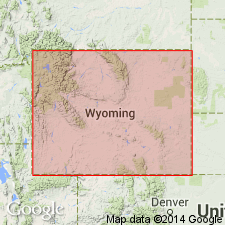
Named as one of five formations of the Libby Creek Group. Accessible outcrops found in T14N, R84W, along Encampment-Hog Park Road at boundary of secs 19 and 30 and at confluence of North Fork of Miner and Copper [source of name] Creeks at boundary of secs 27 and 28, Carbon Co, WY in the Northern Rocky Mountain region. No type locality designated. Considered to be an open framework conglomerate (also called "Copper Creek Tilloid" on a stratigraphic diagram) about 100 m thick that has angular to subrounded granitic clasts and individual mineral grains widely dispersed through a fine-grained actinolitic hornblende-biotite-quartz schist matrix. Clasts make up less than 5 to 80 percent of an individual outcrop. Chlorite, magnetite, and euhedral garnet are accessories. Conformably overlies Bridger Peak Quartzite (new) of Libby Creek Group. Conformably underlies Quartzite Peak Quartzite (new) of Libby Creek. Is 75 to 100 m thick. Geologic map; mapped with other formations of the Libby Creek Group. Assigned a Proterozoic age.
Source: GNU records (USGS DDS-6; Denver GNULEX).
For more information, please contact Nancy Stamm, Geologic Names Committee Secretary.
Asterisk (*) indicates published by U.S. Geological Survey authors.
"No current usage" (†) implies that a name has been abandoned or has fallen into disuse. Former usage and, if known, replacement name given in parentheses ( ).
Slash (/) indicates name conflicts with nomenclatural guidelines (CSN, 1933; ACSN, 1961, 1970; NACSN, 1983, 2005, 2021). May be explained within brackets ([ ]).

