- Usage in publication:
-
- Cope Hollow Formation
- Modifications:
-
- Named
- Dominant lithology:
-
- Tuff
- Basalt
- AAPG geologic province:
-
- Midcontinent region
Summary:
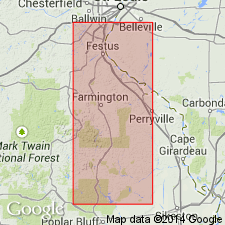
Cope Hollow Formation. Unit is youngest of sequence of Precambrian volcanic rocks associated with Taum Sauk caldera in western part of St. Francois Mountains, southeast Missouri (Midcontinent region). Exposed north of swimming area of Johnson Shut-ins State Park. Divided into four informal units (oldest to youngest): (1) Unit A, black, cross-bedded air-fall tuff, 9 m thick; (2) Unit B, deep-maroon ash-flow tuff with less than 5 percent quartz and feldspar phenocrysts, 5 m thick; (3) Unit C, dark-gray, cross-bedded air-fall tuff containing lithophysae and a basalt lava flow, 28 m thick; and (4) Unit D, maroon ash-flow tuff with 10 percent quartz and feldspar phenocrysts and lithophysae, thickness not known. Overlies Johnson Shut-ins Rhyolite (new). Age is Precambrian. Report includes geologic map. Unit named and described on stratigraphic column (table 1).
Cope Hollow Formation replaces Middlebrook Group (north of swimming area of Johnson Shut-ins State Park) as mapped by Tolman and Robertson (1969, Missouri Geol. Survey Rpt. Inv., no. 44); and upper part of tuff of Johnson Shut-ins of Anderson (1970, Missouri Geol. Survey Rpt. Inv., no. 46).
Type section: exposures north of swimming area of Johnson Shut-ins State Park, in SW/4 NW/4 sec. 16, T. 33 N., R. 2 E., St. Francois Mountains, Johnsons Shut-ins quadrangle, southeast MO. Either named from creek in Reynolds Co., MO, or from town of Cope Hollow.
Source: Modified from GNU records (USGS DDS-6; Denver GNULEX).
For more information, please contact Nancy Stamm, Geologic Names Committee Secretary.
Asterisk (*) indicates published by U.S. Geological Survey authors.
"No current usage" (†) implies that a name has been abandoned or has fallen into disuse. Former usage and, if known, replacement name given in parentheses ( ).
Slash (/) indicates name conflicts with nomenclatural guidelines (CSN, 1933; ACSN, 1961, 1970; NACSN, 1983, 2005, 2021). May be explained within brackets ([ ]).

