- Usage in publication:
-
- Coopers Lake limestone member
- Modifications:
-
- Original reference
- Dominant lithology:
-
- Limestone
- Shale
- Sandstone
- AAPG geologic province:
-
- Montana folded belt
Summary:
Pg. 43 and passim. Coopers Lake limestone member of Jefferson formation. Underlies Lone Butte limestone and overlies Glen Creek shale, all members of Jefferson limestone. Thickest (508 feet) in Dearborn section and thinnest (225 feet) in Wall Creek-Juliet Creek Ridge section. Probably most striking feature is great number of organisms it contains. One of best exposures is in southwestern part of White Ridge, where it consists of (descending): (1) thick-bedded, massive, chocolate to tan, fine-grained limestone containing numerous Jefferson fossils, 132 feet; (2) thick-bedded to shaly tan-gray limestone carrying rich Jefferson fauna, 157 feet; (3) massive, friable, brown, thick-bedded, arenaceous limestone which in some beds becomes essentially a calcareous sandstone, interbedded with thin bands of buff shale, 48 feet. Age is Middle Devonian.
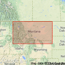
Named for fact it forms a large part of Jefferson limestone over northeastern part of Coopers Lake quadrangle, especially in Powell Co., northwestern MT. Type locality on southeastern slope of southwestern peak of White Ridge, in SW/4 sec. 16, T. 22 N., R. 11 W.
Source: US geologic names lexicon (USGS Bull. 896, p. 513).
For more information, please contact Nancy Stamm, Geologic Names Committee Secretary.
Asterisk (*) indicates published by U.S. Geological Survey authors.
"No current usage" (†) implies that a name has been abandoned or has fallen into disuse. Former usage and, if known, replacement name given in parentheses ( ).
Slash (/) indicates name conflicts with nomenclatural guidelines (CSN, 1933; ACSN, 1961, 1970; NACSN, 1983, 2005, 2021). May be explained within brackets ([ ]).

