

- Usage in publication:
-
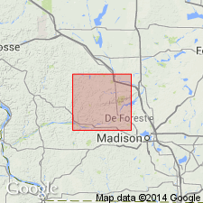
- Coon Valley Member
- Modifications:
-
- Revised
- Dominant lithology:
-
- Sand
- Dolomite
- Chert
- AAPG geologic province:
-
- Wisconsin arch
Summary:
Coon Valley, originally defined as upper member of Jordan Sandstone, here included at base of Oneota Formation. In Sauk Co., WI, Oneota generally consists of approximately 25 m of hard dolomite. Grain sizes vary from very fine sand to medium sand. Dolomite generally ranges from very pale brown to light brownish gray when fresh. White chert nodules and beds occur throughout. Quartz sand, oolitic dolomite, algal structures, and chert near base constitute Coon Valley Member. Elsewhere these sandy beds have been designated Hickory Ridge and Stockton Hill Members.
Source: GNU records (USGS DDS-6; Reston GNULEX).
- Usage in publication:
-
- Coon Valley Member
- Modifications:
-
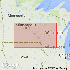
- Areal extent
- Revised
- AAPG geologic province:
-
- Wisconsin arch
- Iowa shelf
Summary:
Coon Valley Member of the Oneota Formation overlies the Jordan Sandstone from southwestern WI, through northeastern IA, to southwestern MN. Contact is now recognized as a regional unconformity that has important implications for the placement of the Cambrian-Ordovician boundary in the Upper Mississippi Valley. A review of the literature reveals that all Ordovician faunas have been collected from above the unconformity, while all reported Cambrian faunas were collected from strata beneath the unconformity. The basal part of the Coon Valley is characterized by a lag deposit composed of poorly sorted, structureless to crudely stratified sandstone with shale and sandstone intraclasts and pebble-sized clasts of Precambrian rock. Near the margins of the Hollandale embayment, the Coon Valley overlies stratigraphically lower parts of the Jordan, providing more evidence for the unconformity.
Source: GNU records (USGS DDS-6; Reston GNULEX).
For more information, please contact Nancy Stamm, Geologic Names Committee Secretary.
Asterisk (*) indicates published by U.S. Geological Survey authors.
"No current usage" (†) implies that a name has been abandoned or has fallen into disuse. Former usage and, if known, replacement name given in parentheses ( ).
Slash (/) indicates name conflicts with nomenclatural guidelines (CSN, 1933; ACSN, 1961, 1970; NACSN, 1983, 2005, 2021). May be explained within brackets ([ ]).