

- Usage in publication:
-
- Coon Creek member*
- Modifications:
-
- Named
- Dominant lithology:
-
- Limestone
- Marl
- Sand
- Clay
- AAPG geologic province:
-
- Upper Mississippi embayment
Summary:
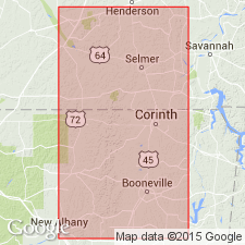
Coon Creek horizon or member of Ripley formation is composed of variable sediments, ranging from local lenses of impure limestone through very fossiliferous marls to glauconitic sands and gypsiferous clays poor in fossils. The sediments containing Coon Creek fauna are dark bluish green and gray clayey sands at base of Ripley formation, a thickness of more than 30 ft of which is exposed along banks of Coon Creek, McNairy Co., TN. Overlies Selma chalk and is separated from overlying McNairy sand member of Ripley by 100 ft of sparsely fossiliferous ferruginous clay. Age is Late Cretaceous.
Source: GNU records (USGS DDS-6; Reston GNULEX).
- Usage in publication:
-
- Coon Creek tongue*
- Modifications:
-
- Revised
- AAPG geologic province:
-
- Upper Mississippi embayment
Summary:
Unit referred to as Coon Creek tongue of Ripley formation, rather than member. Underlies McNairy sand member and overlies Selma formation. Includes at top the 100 ft of ferruginous clay that was originally excluded from it.
Source: GNU records (USGS DDS-6; Reston GNULEX).
- Usage in publication:
-
- Coon Creek tongue*
- Modifications:
-
- Revised
- Overview
- AAPG geologic province:
-
- Upper Mississippi embayment
Summary:
The ferruginous clay appears to be merely a transitional zone between typical Coon Creek tongue and McNairy sand member and, as treated in this report, is included in McNairy sand from which it becomes indistinguishable both to the north and to the south. At type locality, Coon Creek tongue is typified by massive dark- to bluish-gray micaceous glauconitic calcareous fossiliferous silty sand beds that some authors have called "marls." Lower part of unit is gradational into transitional clay in lower part of Ripley and thin interbeds of sand and sandy clay are common. At top of tongue, generally unfossiliferous noncalcareous thin-bedded sand is common. Coon Creek varies in age along outcrop belt. At type locality, sand contains EXOGURA CANCELLATA Stephenson; in MS, a few miles south of State line, member lies entirely above that zone. Sand of Coon Creek grades upward through thinner bedded lighter colored sand and clay beds into McNairy sand member. Thickness as much as 60 ft.
Source: GNU records (USGS DDS-6; Reston GNULEX).
- Usage in publication:
-
- Coon Creek Tongue*
- Modifications:
-
- Age modified
- AAPG geologic province:
-
- Upper Mississippi embayment
Summary:
Coon Creek Tongue, basal unit of Ripley Formation in northeast MS in the Upper Mississippi embayment, is in the NOSTOCERAS (NOSTOCERAS) HYATTI zone of late Campanian age.
Source: GNU records (USGS DDS-6; Denver GNULEX).
- Usage in publication:
-
- Coon Creek Formation
- Modifications:
-
- Overview
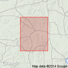
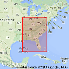
- Areal extent
- AAPG geologic province:
-
- Mississippi embayment
Summary:
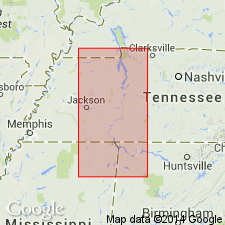
Coon Creek Formation is internationally known for its excellent preservation of fossil marine invertebrates and vertebrates. It is exposed in a northeast to southwest outcrop within the Mississippi embayment in western TN. Consists primarily of nearly 60 m of gray to dark-green, micaceous, glauconitic sands, which are locally fossiliferous. Two lithofacies are recognized within the unit: a lower calcareous sand and clay and an upper concretion-bearing sand and clay. Underlies McNairy Sand and overlies Demopolis and Sardis Formations. Exposure referred to as Thompson Farm Fossil Bed by Conover (1990) along Melton Creek near Enville has been designated a State natural area. It is 52 m long and 7.6 m high. Lowermost 1 m is very fossiliferous and is dominated by CUCULLAEA and CORBULA. Other fauna include turritellid gastropods, echinoids, scaphites, nautiloids, crabs, and sharks.
Source: GNU records (USGS DDS-6; Reston GNULEX).
- Usage in publication:
-
- Coon Creek Formation, Tongue*
- Modifications:
-
- Biostratigraphic dating
- AAPG geologic province:
-
- Upper Mississippi embayment
- Black Warrior basin
Summary:
Age of Coon Creek Formation (in TN), Coon Creek Tongue of Ripley Formation (in MS), and Ripley Formation (in MS, AL, and GA) is Late Cretaceous (late Campanian and early Maastrichtian) as shown in fig. 1. Age based on CRASSATELLA VADOSA collected from McNairy Co. (southwestern TN), Union and Tippah Cos. (northern MS), Barbour Co. (eastern AL), and Quitman Co. (western GA); BATHYTORMUS PTEROPSIS collected from Union, Tippah, Barbour, and Quitman Cos; and SCAMBULA PERPLANA collected from McNairy, Union, Barbour, and Quitman Cos.
Source: GNU records (USGS DDS-6; Reston GNULEX).

- Usage in publication:
-
- Coon Creek Formation*
- Modifications:
-
- Revised
- Areal extent
- AAPG geologic province:
-
- Upper Mississippi embayment
- Illinois basin
Summary:
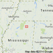
Rocks mapped as Coon Creek Formation by McQueen and Weller (1939, Southwestern Illinois and southeastern Missouri: Kansas Geological Society, 13th Annual Field Conference Guidebook, 176 p.) are designated as Coffee Sand. Coffee Sand crops out mostly as bluffs along Mississippi River and more closely resembles Coffee Sand based on descriptions of sediments of Upper Mississippi embayment described by Pryor (1960). Coffee Sand is mapped undivided with Owl Creek Formation, NcNairy Sand, and Little Bear Formation.
Source: GNU records (USGS DDS-6; Reston GNULEX).
For more information, please contact Nancy Stamm, Geologic Names Committee Secretary.
Asterisk (*) indicates published by U.S. Geological Survey authors.
"No current usage" (†) implies that a name has been abandoned or has fallen into disuse. Former usage and, if known, replacement name given in parentheses ( ).
Slash (/) indicates name conflicts with nomenclatural guidelines (CSN, 1933; ACSN, 1961, 1970; NACSN, 1983, 2005, 2021). May be explained within brackets ([ ]).