

- Usage in publication:
-
- Cooks Canyon formation
- Modifications:
-
- Named
- Dominant lithology:
-
- Volcaniclastics
- AAPG geologic province:
-
- Sierra Nevada province
Summary:
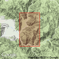
Type locality designated as ridge between Cooks Canyon and Lights Creek, Mount Jura, Plumas Co, CA. Also referred to as Cooks Canyon agglomerate. Also occurs near Forman farm house, Forman Ravine, Forman Ridge and elsewhere. At type locality consists of mostly red agglomerates, containing here and there fossil charcoal of coniferous wood and angular fragments from intrusive quartz porphyry (of middle Late Jurassic age). In Forman ravine and vicinity, consists mostly of coarse, water-laid, clastic sedimentary rocks of volcanic origin, gray to green in color, containing here and there fossil charcoal of coniferous wood (not identifiable). Thickness at type is 1900 ft; at Forman Ravine, 900 ft. Overlies Forman [Foreman] formation; underlies Lucky S Formation. Is middle Late Jurassic age.
Source: GNU records (USGS DDS-6; Menlo GNULEX).

- Usage in publication:
-
- Cooks Canyon Agglomerate*
- Modifications:
-
- Adopted
- AAPG geologic province:
-
- Sierra Nevada province
Summary:
Cooks Canyon Agglomerate of Crickmay (1933) herein adopted. Correlation chart describes unit as breccia, tuff, and sandstone, 1900 ft thick. Overlies Foreman Formation; underlies Lucky S Argillite. Contains no identifiable fossils. Provisionally assigned to Middle Jurassic (Callovian) age based on stratigraphic relations.
Source: GNU records (USGS DDS-6; Menlo GNULEX).
For more information, please contact Nancy Stamm, Geologic Names Committee Secretary.
Asterisk (*) indicates published by U.S. Geological Survey authors.
"No current usage" (†) implies that a name has been abandoned or has fallen into disuse. Former usage and, if known, replacement name given in parentheses ( ).
Slash (/) indicates name conflicts with nomenclatural guidelines (CSN, 1933; ACSN, 1961, 1970; NACSN, 1983, 2005, 2021). May be explained within brackets ([ ]).