- Usage in publication:
-
- Coata sandstone member*
- Modifications:
-
- Original reference
- Dominant lithology:
-
- Sandstone
- AAPG geologic province:
-
- Chautauqua platform
Summary:
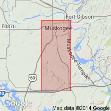
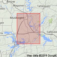
Pg. 503-520. Coata sandstone member, basal member of Atoka formation in Muskogee-Porum district, Muskogee County, eastern Oklahoma. Massive sandstone, medium- to coarse-grained; large pebbles of quartz and chert near base; light to dark brown; fossiliferous. Thickness 40 feet. Separated from overlying Pope Chapel sandstone member by 150 to 220 feet of shale. Unconformably overlies the Morrow formation. Age is Pennsylvanian. Report includes geologic map, columnar sections, measured sections.
Named from exposure along Coata Creek, in secs. 34 and 35, T. 15 N., R. 19 E., Muskogee Co., OK. Also recognized in McIntosh Co.
Source: US geologic names lexicon (USGS Bull. 896, p. 510); supplemental information from GNU records (USGS DDS-6; Denver GNULEX).

- Usage in publication:
-
- Coody sandstone member
- Modifications:
-
- Revised
- AAPG geologic province:
-
- Chautauqua platform
Summary:
R.H. Dott, 1936, Letter dated June 12. One mile south of Muskogee is a stream called Coody Creek, named for one of the old families in the area. An oil field has been named for it, and this name is universally applied. The topographic map shows "Coata." Since "Coata" is meaningless to anyone living or working in the area, I believe this usage should be corrected to Coody.
Source: US geologic names lexicon (USGS Bull. 896, p. 510).

- Usage in publication:
-
- Coody sandstone member
- Modifications:
-
- Overview
- AAPG geologic province:
-
- Chautauqua platform
Summary:
Coody sandstone member, basal member of Atoka formation. Thickness 15 to 115 feet. Separated from overlying Pope Chapel sandstone member by unnamed shale 35 to 72 feet thick. Unconformable with underlying Morrow group.
Source: US geologic names lexicon (USGS Bull. 1200, p. 924).
For more information, please contact Nancy Stamm, Geologic Names Committee Secretary.
Asterisk (*) indicates published by U.S. Geological Survey authors.
"No current usage" (†) implies that a name has been abandoned or has fallen into disuse. Former usage and, if known, replacement name given in parentheses ( ).
Slash (/) indicates name conflicts with nomenclatural guidelines (CSN, 1933; ACSN, 1961, 1970; NACSN, 1983, 2005, 2021). May be explained within brackets ([ ]).

