The National Geologic Map Database is migrating to a new infrastructure. We apologize for any service disruptions during this process.
|
|---|


- Usage in publication:
-
- Conowingo diamictite
- Modifications:
-
- Overview
- Dominant lithology:
-
- Diamict
- AAPG geologic province:
-
- Piedmont-Blue Ridge province
Summary:
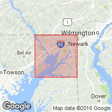
Diamictite crops out in two belts in Cecil Co. Northwestern belt assigned to Sykesville Formation while second belt, southeast of Baltimore Complex, from the vicinity of Conowingo Dam to just south of the town of Rising Sun is informally called the Conowingo diamictite. 13,000 ft (4,000 m) exposed in Cecil Co. Divided into coarse-grained facies, fine-grained facies, mafic zone, and mafic breccia. Coarse-grained part of Conowingo, previously mapped as "boulder gneiss lithofacies" by Southwick and Fisher (1967: MD Rept. Inv. 6), described here as resembling a weakly foliated granite, generally massive and poorly bedded, but contains abundant grains, granules, and scattered pebbles of quartz, and chips, blocks, and slabs (up to 325 ft long) of quartz, quartzite, granofels, gneiss, schist, graywacke, amphibolite, and calc-silicate rock. Many clasts match metavolcanic rocks in James Run Formation and some the Port Deposit Gneiss. Blue quartz grains common. Fine-grained facies considered plutonic or metaplutonic by previous workers. Distribution of the Conowingo in this report differs from that shown on the Geologic map of Cecil County (Higgins and Conant, 1986: MD Geol. Survey). Author concedes that some of the rocks along the Susquehanna River south of Octoraro Creek that he mapped as fine-grained diamictite may be partly of igneous origin as concluded by Southwick (1979: Southeastern Geol., v. 20, no. 2).
Source: GNU records (USGS DDS-6; Reston GNULEX).
For more information, please contact Nancy Stamm, Geologic Names Committee Secretary.
Asterisk (*) indicates published by U.S. Geological Survey authors.
"No current usage" (†) implies that a name has been abandoned or has fallen into disuse. Former usage and, if known, replacement name given in parentheses ( ).
Slash (/) indicates name conflicts with nomenclatural guidelines (CSN, 1933; ACSN, 1961, 1970; NACSN, 1983, 2005, 2021). May be explained within brackets ([ ]).