The National Geologic Map Database is migrating to a new infrastructure. We apologize for any service disruptions during this process.
|
|---|


- Usage in publication:
-
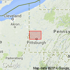
- Connoquenessing sandstone
- Modifications:
-
- Named
- Dominant lithology:
-
- Sandstone
- AAPG geologic province:
-
- Appalachian basin
Summary:
Named Connoquenessing sandstone, Upper Connoquenessing sandstone, and Lower Connoquenessing sandstone. Named for Connoquenessing Creek, Lawrence Co., western PA. Connoquenessing sandstone consists of (descending) very massive, hard, white sandstone, 40 to 50 ft thick; dark sandy shales generally containing iron ore a t top and in some places a thin coal below, 40 to 50 ft thick; and hard, massive, grayish-brown sandstone, 20 to 25 ft thick. Overlies Sharon shales; lies 20 to 80 ft below Upper Homewood sandstone. Upper Connoquenessing sandstone forms upper cliff along Connoquenessing Creek between its mouth and Slippery Rock. Lower Connoquenessing sandstone is frequently seen along bed of Connoquenessing Creek. [Age is Pennsylvanian.]
Source: GNU records (USGS DDS-6; Reston GNULEX).
For more information, please contact Nancy Stamm, Geologic Names Committee Secretary.
Asterisk (*) indicates published by U.S. Geological Survey authors.
"No current usage" (†) implies that a name has been abandoned or has fallen into disuse. Former usage and, if known, replacement name given in parentheses ( ).
Slash (/) indicates name conflicts with nomenclatural guidelines (CSN, 1933; ACSN, 1961, 1970; NACSN, 1983, 2005, 2021). May be explained within brackets ([ ]).