- Usage in publication:
-
- Conglomerate Mesa Formation*
- Modifications:
-
- Original reference
- Biostratigraphic dating
- Dominant lithology:
-
- Limestone
- Sandstone
- Conglomerate
- AAPG geologic province:
-
- Great Basin province
Summary:
Pg. 3 (fig. 2), 6+. Conglomerate Mesa Formation of Owens Valley Group. Primarily sandy limestone, sandstone, and conglomerate. Overlies with angular unconformity Lone Pine Formation (new); paraconformably underlies unnamed Triassic strata. Thickness 173 m at type section; ranges up to about 225 m thick nearby. Present in southern Inyo Mountains and central Argus Range. Age is Late Permian (late Guadalupian) based on reported presence of ammonoid TIMORITES, a primary index fossil of the Capitanian Stage of Furnish (1973).
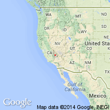
Type section (= type section of Lone Pine Formation): exposures in hill, locally called Permian Bluff, on west side of Inyo Mountains about 5 km northwest of Cerro Gordo Mine in southern part of New York Butte 15-min quadrangle, Inyo Co., eastern CA. Named from Conglomerate Mesa, a prominent mesa located about 5 km south of Cerro Gordo Mine in southernmost corner of New York Butte 15-min quadrangle, Inyo Co., eastern CA.
Reference locality (= type locality of Owens Valley Formation, Merriam and Kirk, 1957): in foothills between Union Wash and Reward Mine about 9 mi southeast of Independence, between Owenyo and Kearsarge, in NE/4 Lone Pine 15-min quadrangle, southern Inyo Mountains, Inyo Co., eastern CA.
Source: Publication; GNU records (USGS DDS-6; Menlo GNULEX).
For more information, please contact Nancy Stamm, Geologic Names Committee Secretary.
Asterisk (*) indicates published by U.S. Geological Survey authors.
"No current usage" (†) implies that a name has been abandoned or has fallen into disuse. Former usage and, if known, replacement name given in parentheses ( ).
Slash (/) indicates name conflicts with nomenclatural guidelines (CSN, 1933; ACSN, 1961, 1970; NACSN, 1983, 2005, 2021). May be explained within brackets ([ ]).

