

- Usage in publication:
-
- Congaree shales, phase
- Modifications:
-
- Named
- Dominant lithology:
-
- Shale
- Sand
- Marl
- AAPG geologic province:
-
- Atlantic Coast basin
Summary:
"The Congaree phase exhibits its littoral line in Aiken Co. along Hollow Creek, near Savannah River and extends easterly with occasional tongues forming shore line indicated for Tertiary. It is delimited on south by a line extending from mouth of Hollow Creek (Aiken Co.) along Tinkers Creek north of Kennedy's Bluff by Binnaker's Bridge (South Fork Edisto River), by Springfield, by Orangeburg, by Jenkins Hill, by Warley Hill, and by Fullers Earth Creek. From this point the formation apparently constitutes narrow bands whose respective lines around the Carolina Ridge and by Catchall and Naked Creek probably follow the littoral line indicated for the Tertiary in general description. The Congaree shales in some localities grade upward to a pea-green marl (Kennedy's Bluff on Tinkers Creek; Binnaker's Bridge on Edisto River; Wannamakers Kiln on Caw Caw Swamp; and to a limited extent at Warleys Hill). The materials consist of buhrstone and sands, shales, and marl. Named for exposures on western scarp on Congaree River and the embayments of its tributaries to Lang Syne and Warley Hill, Orangeburg Co."
Source: GNU records (USGS DDS-6; Reston GNULEX).
- Usage in publication:
-
- Congaree phase†
- Modifications:
-
- Abandoned
- AAPG geologic province:
-
- Atlantic Coast basin
Summary:
Fossils from Congaree phase of Sloan show that it included part of Black Mingo formation (of Wilcox age) and lower part of McBean formation (of Claiborne age), and it is abandoned. Its type locality appears to be on Elmore Williams' place at head of First Creek, 0.8 mi west of Gaston, Lexington Co., South Carolina.
Source: GNU records (USGS DDS-6; Reston GNULEX).

- Usage in publication:
-
- Congaree formation*
- Modifications:
-
- Reinstated
- AAPG geologic province:
-
- Atlantic Coast basin
Summary:
Though Sloan's Congaree phase was only vaguely defined, he evidently intended it to include clay, sand, and buhrstone of early Claiborne age. Veatch and Stephenson (1911, Georgia Geologic Survey Bull. 26) accepted Congaree in this sense for use in GA and described Congaree clay as basal member of McBean formation, oldest formation of Claiborne age known to them there. How much of their Congaree is Claiborne is still uncertain. Cooke and Shearer (1918, USGS Prof. Paper 120-C) supposed that all their Congaree was Jackson and transferred it to Barnwell formation under name of Twiggs clay member. Later Cooke (1943, USGS Bull. 941) restored that facies consisting of thin-bedded or laminated sand and clay to McBean formation. It now appears that deposits of Claiborne and Jackson age have never been properly delimited in either GA or SC. A large part of the deposits in GA mapped as Barnwell is of Claiborne age. This includes much of Twiggs clay member of Barnwell of eastern GA. Name Congaree is here revived and deemed of formational rank because it is equivalent to the Tallahatta formation of MS and AL. Term formation is preferred to clay or shale because much sand as well as clay and shale are included. At designated typical exposure, formation is 21 ft thick and unconformably underlies Warley Hill marl. Overlies Black Mingo formation. Included in lower Claiborne.
Source: GNU records (USGS DDS-6; Reston GNULEX).
- Usage in publication:
-
- Congaree Formation
- Modifications:
-
- Overview
- AAPG geologic province:
-
- Atlantic Coast basin
Summary:
Authors follow Colquhoun and others (1983) and Nystrom and others (this volume) and herein assign all middle Eocene sediments of the outer Coastal Plain of SC to the Orangeburg Group. Therefore, in the outer Coastal Plain, the group includes the Congaree Formation, the Santee Limestone, and the lower part of the Cross Formation. [This last assignment is in conflict with the 1983 Code, Art. 28(b). The Cross Formation was determined to be one depositional sequence of middle and late Eocene age by Zullo and Harris (1987).]
Source: GNU records (USGS DDS-6; Reston GNULEX).

- Usage in publication:
-
- Congaree Formation
- Modifications:
-
- Overview
- AAPG geologic province:
-
- Atlantic Coast basin
Summary:
Authors include the Huber, Congaree, Warley Hill and McBean Formations in the Orangeburg Group. The Huber and the Congaree are age equivalent (early middle Eocene) facies and correlate with the Tallahatta Formation of AL. The Congaree is mainly composed of pale yellow, loose, moderately- to well-sorted, medium-grained quartz sand to poorly-sorted, medium- to very coarse grained quartz sand, with little or no interstitial clay. Includes locally indurated, brittle claystone beds. Boundary between the updip kaolinitic Huber Formation and the downdip Congaree is gradational and is drawn between Jackson, near the Savannah River, and Swansea, located on the interfluve just southwest of the Congaree River. Congaree is 11 to 15 m thick near Fort Motte in Calhoun Co. but thins downdip to 4.6 m at the head of Warley Creek. Early middle Eocene age of the unit is indicated by the bivalve ANODONTIA AUGUSTANA.
Source: GNU records (USGS DDS-6; Reston GNULEX).
- Usage in publication:
-
- Congaree Formation
- Modifications:
-
- Overview
- Age modified
- AAPG geologic province:
-
- Atlantic Coast basin
Summary:
Congaree consists of orange, yellow, tan, gray, and greenish gray, moderately and well-sorted, fine to coarse quartz sands. Similar to the underlying Fourmile Formation (new), which was mapped by Siple (1967) and Logan and Euler (1989) as part of the Congaree. Presence of a silicified zone at the top of the Fourmile suggests an unconformable contact. Congaree crops out in the northeastern part of the study area. Correlative sediments to the northwest have been mapped as part of the Huber Formation, but the Huber is more micaceous and poorly sorted. Congaree ranges in thickness from 60 ft at the northwestern boundary of the Savannah River site to 80 ft near the southeastern boundary. In GA it appears to be thinner and more argillaceous. Corresponds in stratigraphic position to part of the lower "Bamberg" and Neeses" as used by Oldham (1981) and Colquhoun and others (1983) and to parts of the "McBean" and "Aiken" Formations as used by Steele (1985). Underlies middle Eocene Warley Hill Formation. Assigned to zones NP 12, 13, and 14 (early to early middle Eocene) based on a few palynological dates and its stratigraphic position. Equivalent to the Tallahatta Formation of the Gulf Coast. Shallow marine and barrier environments of deposition indicated.
Source: GNU records (USGS DDS-6; Reston GNULEX).

- Usage in publication:
-
- Congaree Formation*
- Modifications:
-
- Overview
- AAPG geologic province:
-
- Atlantic Coast basin
Summary:
The Congaree has been correlated with the lower middle Eocene Tallahatta Formation of Alabama by Nystrom and others (1989) and by Harris and Zullo (1991). In the study area, the two lower middle Eocene sequences (=Congaree) contain age-diagnostic fossils in several cores that establish their age and correlation.
Source: GNU records (USGS DDS-6; Reston GNULEX).
- Usage in publication:
-
- Congaree Formation*
- Modifications:
-
- Mapped 1:100k
- Areal extent
- Dominant lithology:
-
- Not stated
- AAPG geologic province:
-
- Atlantic Coast basin
- South Georgia sedimentary province
Summary:
Pg. 5, 8-9, 14, 21, geol. map. Congaree Formation of Cooke and MacNeil (1952). Open-marine delta-front deposits. Previously included in Tuscaloosa Formation by Cooke (1936, USGS Bull. 867). Mapped with Huber Formation, undivided. Believed to be a facies of Huber; mineralogy is identical, but sorting and bed forms change with respect to position on the delta. Formations can interfinger, but marine Congaree is usually found below the prograding fluvial Huber. Best exposures in larger tributaries (Upper Three Runs Creek and upper Edisto River valley) to Savannah River. Underlies McBean Formation. Age is lower middle Eocene (Lutetian; Claibornian), based on fossils (dinoflagellates and pollen identified by L.E. Edwards and N.O. Frederiksen, USGS, written commun., 1982-1985).
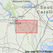
Best exposure in quadrangle (Huber and Congaree Formations, undivided): Dixie Clay Company McNamee No. 2 strip mine, about 1.5 mi southeast of Bath, SC.
Source: Publication.
- Usage in publication:
-
- Congaree Formation
- Modifications:
-
- Overview
- AAPG geologic province:
-
- Atlantic Coast basin
Summary:
Name of underlying unit in study area renamed Fourmile Branch Formation.
Source: GNU records (USGS DDS-6; Reston GNULEX).
For more information, please contact Nancy Stamm, Geologic Names Committee Secretary.
Asterisk (*) indicates published by U.S. Geological Survey authors.
"No current usage" (†) implies that a name has been abandoned or has fallen into disuse. Former usage and, if known, replacement name given in parentheses ( ).
Slash (/) indicates name conflicts with nomenclatural guidelines (CSN, 1933; ACSN, 1961, 1970; NACSN, 1983, 2005, 2021). May be explained within brackets ([ ]).