- Usage in publication:
-
- Concord Pond member*
- Modifications:
-
- Named
- Dominant lithology:
-
- Gneiss
- AAPG geologic province:
-
- New England province
Summary:
Pg. 36-43, pls. 1, 2. Concord Pond member of Littleton formation [author does not capitalize rank terms; however, units are considered formal]. Consists mainly of gray-weathered coarse-grained quartz-feldspar-two mica-sillimanite, migmatitic gneiss interbedded with lesser amounts of gray to dull-brown quartz-feldspar-biotite granulite. Included in member are one or more 50- to 75-foot-thick horizons of calc-silicate granulite. In syncline that plunges northward from South Woodstock it is possible to consider half of outcrop pattern and obtain minimum thickness of 1,700 feet for unit. Estimated thickness 3,400 feet in northwest-plunging syncline in vicinity of Chamberlain Mountain. Assuming a one-third repetition of bedding due to folding, a thickness of 2,500 feet is reasonable estimate. Underlies Wilbur Mountain member (new); overlies Billings Hill formation (new). Age is Early Devonian.
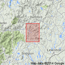
Type locality: Concord Pond in Bryant Pond quadrangle, western ME. Also well exposed on Kimball Hill, Mount Zircon, Bean Mountain, and Davis Mountain. Named from Concord Pond.
Source: US geologic names lexicon (USGS Bull. 1350, p. 167).
For more information, please contact Nancy Stamm, Geologic Names Committee Secretary.
Asterisk (*) indicates published by U.S. Geological Survey authors.
"No current usage" (†) implies that a name has been abandoned or has fallen into disuse. Former usage and, if known, replacement name given in parentheses ( ).
Slash (/) indicates name conflicts with nomenclatural guidelines (CSN, 1933; ACSN, 1961, 1970; NACSN, 1983, 2005, 2021). May be explained within brackets ([ ]).

