- Usage in publication:
-
- Conant limestone member
- Modifications:
-
- Original reference
- Dominant lithology:
-
- Limestone
- AAPG geologic province:
-
- Illinois basin
Summary:
Pg. 35, 48 (table 1), pl. 1. Conant limestone member of Carbondale formation of Kewanee group (new). Proposed for limestone formerly called Jamestown. Name Jamestown to be used for coal member underlying the Conant. Stratigraphically below Anvil Rock sandstone member. Age is Pennsylvanian. Presentation of new rock-stratigraphic classification of Pennsylvanian of Illinois. Cyclical classification retained but is entirely independent of rock-stratigraphic classification.
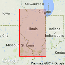
Type locality [Wanless, 1939, GSA Spec. Paper 17, p. 17, 88; 1956, Illinois Geol. Survey Circ. 217, p. 10]: in NW/4 NE/4 sec. 34, T. 5 S., R. 4 W., Perry Co., southern IL. Named from village of Conant, about 2 mi east of type locality.
Source: US geologic names lexicon (USGS Bull. 1200, p. 906); supplemental information from 1975 Illinois handbook of stratigraphy (p. 192).

- Usage in publication:
-
- Conant Limestone Member
- Modifications:
-
- Overview
- Dominant lithology:
-
- Limestone
- AAPG geologic province:
-
- Illinois basin
Summary:
Pg. 166 (chart), 192. Conant Limestone Member of Carbondale Formation of Kewanee Group. Previously called Jamestown Limestone (Bell et al., 1931, Illinois Geol. Survey Petroleum, no. 19, p. 3). Argillaceous limestone locally resembling Brereton Limestone. Generally less than 1 foot thick. Lies immediately above Jamestown Coal. In Perry County it is as much as 4 feet thick in places and is separated from Jamestown Coal by an equal thickness of dark gray shale. Underlies gray silty shale. Age is Middle Pennsylvanian (Desmoinesian). Characterized by an open-marine fauna dominated by large productid brachiopod DICTYOCLOSTUS.
Type locality (Wanless, 1939, GSA Spec. Paper 17, p. 17, 88; 1956, Illinois Geol. Survey Circ. 217, p. 10): in NW/4 NE/4 sec. 34, T. 5 S., R. 4 W., Perry Co., southern IL. Named from village of Conant, about 2 mi east of type locality. Widespread from St. Clair to Gallatin Counties, southern Illinois. Present locally in eastern Illinois.
Source: Publication.
For more information, please contact Nancy Stamm, Geologic Names Committee Secretary.
Asterisk (*) indicates published by U.S. Geological Survey authors.
"No current usage" (†) implies that a name has been abandoned or has fallen into disuse. Former usage and, if known, replacement name given in parentheses ( ).
Slash (/) indicates name conflicts with nomenclatural guidelines (CSN, 1933; ACSN, 1961, 1970; NACSN, 1983, 2005, 2021). May be explained within brackets ([ ]).

