

- Usage in publication:
-
- Comus formation*
- Modifications:
-
- Mapped
- Dominant lithology:
-
- Chert
- Slate
- Argillite
- AAPG geologic province:
-
- Great Basin province
Summary:
Comus formation. Interbedded chert, slate, and argillite. Chert is dark gray, green, brown, and black. Slate and argillite are dark gray, green, or black. Rocks are highly folded and faulted; no section was measured. Thickness estimated to be 2,000+ feet. Generally forms smooth slopes. Is oldest formation in study area. Unconformably overlain by Pennsylvanian Battle formation (new); in thrust contact with Middle(?) Ordovician Valmy formation (new). Barren of identifiable fossils in study area (Antler Peak 15-min quadrangle). At type, rocks yielded Early Ordovician graptolites. Age is considered Early Ordovician.
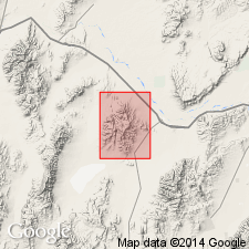
Type locality stated to be near Comus, Golconda quadrangle, Humboldt Co., north-central NV [see Ferguson and others, 1952, Geol. Golconda quadrangle, Nevada, USGS GQ-15, scale 1:125,000]. Notable exposures on North Peak and in valleys of Trout and Cottonwood Creeks, Humboldt and Lander Cos., north-central NV.
Source: Publication; US geologic names lexicon (USGS Bull. 1200, p. 905); GNU records (USGS DDS-6; Menlo GNULEX).
- Usage in publication:
-
- Comus formation*
- Modifications:
-
- Named
- Biostratigraphic dating
- Dominant lithology:
-
- Slate
- Limestone
- Quartzite
- AAPG geologic province:
-
- Great Basin province
Summary:
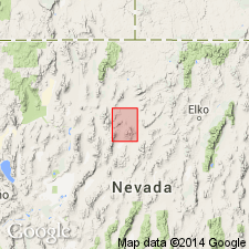
Named from Comus station at eastern end of Emigrant Canyon, 5 mi north of outcrop area in Edna Mountains. Golconda 30' quad, Humboldt Co, NV. Consists of dark slate, in part siliceous, grading to chert; some dark impure limestone; and brown fine-grained quartzite. Thickness is about 3000 ft, uncertain due to close folding. In thrust contact with Valmy formation. Locally overlies Preble formation (new). Unconformably underlies Battle formation. Contains fossil TETRAGRAPTUS indicating Early Ordovician age.
Source: GNU records (USGS DDS-6; Menlo GNULEX).
- Usage in publication:
-
- Comus formation*
- Modifications:
-
- Areal extent
- AAPG geologic province:
-
- Great Basin province
Summary:
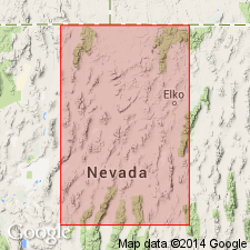
Comus formation was mapped in Golconda 30' quad (Ferguson and others, 1952) as in normal contact with Preble formation; restudy of type locality has shown contact is high-angle fault. Chert and shale unit on northwest side of Battle Mountain, originally assigned to Comus, is now referred to upper part of Valmy formation, because it contains no carbonate beds.
Source: GNU records (USGS DDS-6; Menlo GNULEX).
- Usage in publication:
-
- Comus formation*
- Modifications:
-
- Areal extent
- Age modified
- Biostratigraphic dating
- AAPG geologic province:
-
- Great Basin province
Summary:
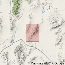
Comus formation occupies tongue-like thrust plate overlying Preble formation along crest and eastern side of range at northern end of Osgood Mountains. Is predominantly alternating sequence of dolomite, limestone, and shale with subordinate amounts of chert, siltstone, and tuffaceous(?) material. Generalized section south of Granite Creek is described; thickness estimated to be 3200 to 4600 ft. Age based on graptolites and mold of trilobite probably ranges from Early to Middle Ordovician and may be as old as Late Cambrian.
Source: GNU records (USGS DDS-6; Menlo GNULEX).
- Usage in publication:
-
- Comus Formation*
- Modifications:
-
- Biostratigraphic dating
- AAPG geologic province:
-
- Great Basin province
Summary:
CORDYLODUS PROAVUS Zone conodonts (latest Cambrian and earliest Ordovician age) occur in Comus (and other) Formation.
Source: GNU records (USGS DDS-6; Menlo GNULEX).
- Usage in publication:
-
- Comus Formation*
- Modifications:
-
- Age modified
- AAPG geologic province:
-
- Great Basin province
Summary:
Age is Late Cambrian to Middle Ordovician [based on Late Cambrian and Early Ordovician assignment for unit in northern Shoshone Range --see also Ethington and Repetski (1984)]
Source: GNU records (USGS DDS-6; Menlo GNULEX).
For more information, please contact Nancy Stamm, Geologic Names Committee Secretary.
Asterisk (*) indicates published by U.S. Geological Survey authors.
"No current usage" (†) implies that a name has been abandoned or has fallen into disuse. Former usage and, if known, replacement name given in parentheses ( ).
Slash (/) indicates name conflicts with nomenclatural guidelines (CSN, 1933; ACSN, 1961, 1970; NACSN, 1983, 2005, 2021). May be explained within brackets ([ ]).