- Usage in publication:
-
- Comanche Point Member
- Modifications:
-
- Named
- Dominant lithology:
-
- Sandstone
- Mudstone
- AAPG geologic province:
-
- Southern Rocky Mountain region
Summary:
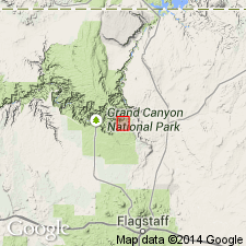
Named as one of four members of Dox Formation (redefined) of Unkar Group [of Grand Canyon Supergroup] for Comanche Point, a promontory on the southeast side of Colorado River, between Tanner Canyon and Comanche Creek, Coconino Co, AZ in Southern Rocky Mountain region. Type designated 1.6 km west of Comanche Point in an unnamed creek tributary to Tanner Canyon. Is 155 m thick at type. Is 190 m thick 5 km west of Cardenas Creek, and 115 m thick near Monocline Butte 6 km to north. Base placed at top of highest resistant sandstone bed of underlying Solomon Temple Member (new) of Dox. Top is placed at uppermost occurrence of a bleached white marker unit, or at gradation from interbedded sandstone and siltstone to massive siltstone of the younger Ochoa Point Member (new) of Dox. Characterized by five laterally continuous marker units of white and lavender interbedded sandstone and mudstone in a red-brown, slope-forming mudstone. At most localities a dolomitic stromatolitic bed 2-6 m thick occurs above the lowest marker. Has ripple marks, mud crack casts, low-angle cross beds. Is a tidal-flat deposit. Of late Precambrian age. Geologic map.
Source: GNU records (USGS DDS-6; Denver GNULEX).
For more information, please contact Nancy Stamm, Geologic Names Committee Secretary.
Asterisk (*) indicates published by U.S. Geological Survey authors.
"No current usage" (†) implies that a name has been abandoned or has fallen into disuse. Former usage and, if known, replacement name given in parentheses ( ).
Slash (/) indicates name conflicts with nomenclatural guidelines (CSN, 1933; ACSN, 1961, 1970; NACSN, 1983, 2005, 2021). May be explained within brackets ([ ]).

