- Usage in publication:
-
- Colvin Mountain Sandstone
- Modifications:
-
- Original reference
- Dominant lithology:
-
- Sandstone
- AAPG geologic province:
-
- Appalachian basin
Summary:
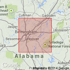
Pg. 48-50; App., p. 226-227. Colvin Mountain Sandstone. Light-gray, thick- to thin-bedded, massive orthoquartzite sandstone with two bentonite beds. [J.T. Haynes, GSA Spec. Paper 290, 1994, identified these bentonites as (descending) the Millbrig (T-4) and the Deicke (T-3), based on mineralogic analyses.] Thickness averages 70 feet; at Alexander Gap is 75 feet thick. Overlies Greensport Formation (new) and underlies Sequatchie Formation. Lithologically similar to, and considered correlative with, top of Bays Formation of eastern Tennessee. Age is Middle Ordovician (Rocklandian to Kirkfieldian), based on stratigraphic position.
[Type locality: excellent exposures along US Hwy 431 in the cut through Colvin Mountain, called Alexander Gap, Glencoe 7.5-min quadrangle, Calhoun Co., northeastern AL.]
Source: Publication; Alabama Geol. Survey Circ. 140, p. 36; US geologic names lexicon (USGS Bull. 1520, p. 68).

- Usage in publication:
-
- Colvin Mountain Sandstone
- Modifications:
-
- Areal extent
- AAPG geologic province:
-
- Appalachian basin
Summary:
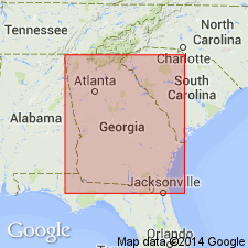
Authors propose that terminology used by Drahovzal and Neathery (1971) for strata in northeastern AL be introduced for Horseleg Mountain, Dunaway Gap (Johns Mountain), and other sections of northwestern GA where Colvin Mountain Sandstone is recognized. Where the Colvin Mountain is absent, red beds of Sequatchie and Greensport are best mapped as a single unit, the Bays Formation. Colvin Mountain is composed of white quartz arenite, distinct from the red beds above and below. Unit is always associated with T3 or T4 bentonites at its base. Age is Middle Ordovician.
Source: GNU records (USGS DDS-6; Reston GNULEX).

- Usage in publication:
-
- Colvin Mountain Sandstone*
- Modifications:
-
- Areal extent
- AAPG geologic province:
-
- Appalachian basin
Summary:
The Colvin Mountain Sandstone of Drahovzal and Neathery (1971), of the Chickamauga Group in AL and the Chickamauga Supergroup in GA, as redefined by Neathery (1986), in the Kingston and Clinchport thrust sheets, is used in this report. Overlies the Greensport Formation and underlies the Sequatchie Formation.
Source: GNU records (USGS DDS-6; Reston GNULEX).

- Usage in publication:
-
- Colvin Mountain Sandstone
- Modifications:
-
- Overview
- AAPG geologic province:
-
- Appalachian basin
Summary:
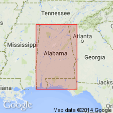
Pg. 36, pl. Colvin Mountain Sandstone. Light- to very light-gray orthoquartzitic, slightly iron-stained, thick- and thin-bedded, often massive, medium- to coarse-grained, well-sorted sandstone containing local concentrations of small pebbles. Near the top of the sandstone are two layers of light-gray to greenish-gray very sandy bentonite. Present in the northern part of the eastern Valley and Ridge, in Calhoun, St. Clair, southeastern Etowah, and southeastern Cherokee Counties, northeastern Alabama. Thickness ranges from 15 to 75 feet, averaging 70 feet. Underlies Sequatchie Formation; overlies Greensport Formation. Age is Middle Ordovician (Rocklandian to Kirkfieldian).
See Drahovzal and Neathery (1971).
Source: Publication.
For more information, please contact Nancy Stamm, Geologic Names Committee Secretary.
Asterisk (*) indicates published by U.S. Geological Survey authors.
"No current usage" (†) implies that a name has been abandoned or has fallen into disuse. Former usage and, if known, replacement name given in parentheses ( ).
Slash (/) indicates name conflicts with nomenclatural guidelines (CSN, 1933; ACSN, 1961, 1970; NACSN, 1983, 2005, 2021). May be explained within brackets ([ ]).

