The National Geologic Map Database is migrating to a new infrastructure. We apologize for any service disruptions during this process.
|
|---|


- Usage in publication:
-
- Columbia lava*
- Modifications:
-
- Original reference
- Dominant lithology:
-
- Basalt
- AAPG geologic province:
-
- Eastern Columbia basin
Summary:
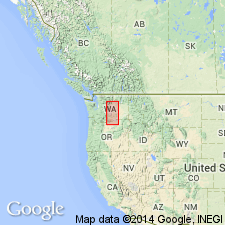
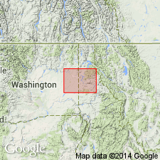
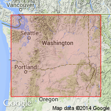
Pg. 20-22. Resting unconformably on Kittitas system and overlapping it to the north, there is a great series of lava sheets, composed principally of basaltic rocks, which extend with unbroken continuity, not only over whole of Douglas County, but larger part of Yakima and Kittitas Counties, Washington, and besides are known to pass southward beyond boundaries of Washington. Although this great series of lava sheets is irregular in many ways and of an entirely different origin from the sediments above and below it, yet it forms the most important geological series in the Northwest. As region it occupies is drained almost entirely by Columbia River, I venture to name it Columbia lava. So far as known this is most extensive formation of its kind in the world. It is known to occupy large portions of Oregon and Idaho and to extend into northern California. Its estimated area is 200,000+/- sq. mi. It is traversed by Snake River throughout its entire course, and by the Columbia from near mouth of Spokane River to where the Columbia breaks through Cascade Mountains, a distance of 800 miles. The streams tributary to the Columbia from the south, below mouth of the Snake, also drain the same great lava field. The Columbia lava is not one vast flow, but is composed of many separate flows, sometimes separated by land surfaces, which frequently contain the stumps of large trees, or by sheets of lapilli. The sheets of which it is composed overlap and supplement each other, so as to form one continuous but highly compound system. No single sheet can be traced over entire field, but in sides of deep canyons that have been eroded in its surface individual flows may be followed continuously for a score or more of miles. The entire series varies in thickness from 300 or 400 feet or less along rim of canyon of Columbia, on northwest border of Douglas County, to 3,700 feet, according to Le Conte, in Cascade Mountains at the Dalles. Its average thickness is probably about 2,000 feet. In the best sections of Columbia lava exposed in coulees or canyons is Douglas County and the remarkable gates eroded by Yakima River through ridges of same material there are frequently 6 or 8 distinct layers of basalt exposed, from 50 to 150 feet thick. The rock is usually a compact bluish black basalt, with frequently a well-defined columnar structure, but it is also at times vesicular and scoriaceous, especially on surfaces of the sheets. Near upper surface of Columbia lava in Yakima region there is a thin layer of clay formed as a sediment in a Tertiary lake and later covered by a lava flow 100 feet thick. Above this bed of basalt and resting evenly on its surface are gravels and fine, evenly bedded lacustral sediments 125 feet thick. Then comes a sheet of columnar basalt 40 to 100 feet thick, which can be traced from the hills about Ellensburg eastward to Columbia River and appears again in eastern part of Saddle Mountain. Above this layer are the lacustral deposits of John Day system. The presence of Miocene lake beds on the surface of Columbia lava and the occurrence of Kittitas system of probable Eocene age below it, show that the volcanic outbursts belong somewhere near middle of Tertiary. [The map accompanying this report covers Yakima, Kittitas, Okanogan, and Douglas Counties and parts of counties adjacent on the east.]
Source: US geologic names lexicon (USGS Bull. 896, p. 494).
- Usage in publication:
-
- Columbia River Basalt Group*
- Columbia River Basalt*
- Modifications:
-
- Revised
Summary:
Pg. 6, 7 (table 1). Columbia River Basalt Group. The term Columbia River Basalt had long been applied to extrusive volcanic rocks of the Columbia Plateau, Washington, Oregon, and Idaho, that are predominantly basaltic. This term was raised by Waters (1961, p. 607) to group rank, the Columbia River Group, when these basalts were subdivided into the Picture Gorge Basalt and the overlying Yakima Basalt. However, the later inclusion into the group of interfingering largely nonbasaltic formations, such as the Mascall Formation, a fluvial sedimentary deposit (Thayer and Brown, 1966), has seriously modified Waters' original definition of the group. Reference to only its basalt now required the awkward phrase "basalt of the Columbia River Group." This problem in definition and nomenclature was discussed in late 1974 by Survey and non-Survey volcanologists, petrographers, and stratigraphers, and it was generally agreed to exclude formations that are largely nonbasaltic. This usage is followed in this report, and the name Columbia River Group is here redesignated the "Columbia River Basalt Group" (table 1) to reflect this restricted usage. (Columbia River Basalt remains in good usage where it can not be subdivided.) Age is middle Miocene to early Pliocene.
Source: Publication; Changes in stratigraphic nomenclature, 1976 (USGS Bull. 1435-A, p. A23).
- Usage in publication:
-
- Columbia River Basalt Group*
- Modifications:
-
- Revised
- Age modified
- AAPG geologic province:
-
- Eastern Columbia basin
Summary:
Columbia River Basalt Group. Divided into (ascending) Imnaha Basalt, Picture Gorge Basalt, and Yakima basalt subgroup [informal]. Age is early, middle, and late Miocene, based on K-Ar ages and on the age of the fossil vertebrates contained within the interbedded Ellensburg Formation.
[Yakima basalt subgroup considered informal and should not be capitalized. "Subgroup" not recognized as a formal stratigraphic rank term (CSN, 1933; ACSN, 1961, 1970; NACSN, 1983, 2005, 2021).]
Source: Publication; Changes in stratigraphic nomenclature, 1979 (USGS Bull. 1502-A, p. A16-A17).
For more information, please contact Nancy Stamm, Geologic Names Committee Secretary.
Asterisk (*) indicates published by U.S. Geological Survey authors.
"No current usage" (†) implies that a name has been abandoned or has fallen into disuse. Former usage and, if known, replacement name given in parentheses ( ).
Slash (/) indicates name conflicts with nomenclatural guidelines (CSN, 1933; ACSN, 1961, 1970; NACSN, 1983, 2005, 2021). May be explained within brackets ([ ]).