The National Geologic Map Database is migrating to a new infrastructure. We apologize for any service disruptions during this process.
|
|---|


- Usage in publication:
-
- Colton formation
- Modifications:
-
- Overview
- AAPG geologic province:
-
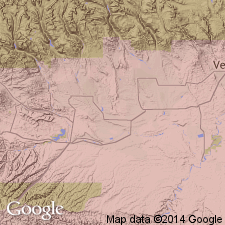
- Uinta basin
Summary:
Pg. 120-121, pls. 2, 3. Colton formation. Consists of reddish-pink sandstones and shales. Varies greatly in thickness; about 3,400 feet near town of Green River, central Utah; near Soldier Summit, disappears into Green River formation. Believed to be equivalent in age to part of Green River formation with which it interfingers on its upper boundary. May correlate with unit herein referred to as Uinta(?). Exposed in extreme southwestern part of Uinta basin. Forms base of Roan Cliffs from Price River to Roan Plateau in Colorado. Age is Eocene.
Source: US geologic names lexicon (USGS Bull. 1200, p. 894-895).
- Usage in publication:
-
- Colton formation*
- Modifications:
-
- Named
- Dominant lithology:
-
- Sandstone
- Siltstone
- Shale
- AAPG geologic province:
-
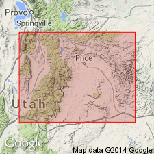
- Wasatch uplift
Summary:
Named for exposures in hills north of Colton, Utah Co, UT on the Wasatch uplift. These exposures implied to be the type locality. These strata were formerly assigned to the Wasatch as its upper member. Grades west into beds of Green River Formation. Well exposed to east of type. Almost entirely absent on most of the Wasatch Plateau. Consists of gray, pepper-and-salt sandstone, greenish-buff sandstone and siltstone that commonly weathers golden brown, and shale ranging from deep red to variegated gray. Is 1,500 ft thick 2 mi east of Colton. Lies above Flagstaff limestone and beneath Green River formation. Easy to recognize because it lies above the limestone and beneath the gray to white shale of the Green River, although individual strata of Green River are irregular and discontinuous. Is of floodplain and channel origin. Only a few freshwater mollusks identified in Colton. Relationship to Wasatch formation not known. Considered to be of Tertiary, late Wasatch age. Cross section. Stratigraphic table.
Source: GNU records (USGS DDS-6; Denver GNULEX).
- Usage in publication:
-
- Colton Formation
- Modifications:
-
- Revised
- AAPG geologic province:
-
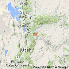
- Wasatch uplift
Summary:
A gray thin-bedded to massive sandstone and brown mudstone that lies above the Middle Fork Tongue (new name) of Green River Formation and below the Soldier Summit Member (new) of the Green River in sec 14, T11S, R8E, Utah Co, UT on the Wasatch uplift, named Tabbyune Creek Tongue of Colton. Stratigraphic charts. Measured section of new tongue. Of Eocene age.
Source: GNU records (USGS DDS-6; Denver GNULEX).
- Usage in publication:
-
- Colton Formation*
- Modifications:
-
- Areal extent
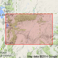
- AAPG geologic province:
-
- Uinta basin
Summary:
Is a red bed sequence in the subsurface on the north side of the Uinta basin, UT above the Flagstaff Member which is reduced in stratigraphic rank and assigned in subsurface to rocks below the main body of the Green River Formation. Paleocene-Eocene boundary placed in upper third of Colton on basis of palynomorph, ostracode, and charophyte assemblages.
Source: GNU records (USGS DDS-6; Denver GNULEX).

- Usage in publication:
-
- Colton Formation*
- Modifications:
-
- Age modified
- AAPG geologic province:
-
- Paradox basin
- Uinta basin
Summary:
Is of Paleocene to early Eocene age in Price Canyon, Sunnyside, and Green River areas, Paradox basin. Is of Paleocene age only on the East Wasatch Plateau, Paradox basin. Palynomorphs identified in SW1/4 sec 35, T15S, R14E, Carbon Co in the Uinta basin.
Source: GNU records (USGS DDS-6; Denver GNULEX).
For more information, please contact Nancy Stamm, Geologic Names Committee Secretary.
Asterisk (*) indicates published by U.S. Geological Survey authors.
"No current usage" (†) implies that a name has been abandoned or has fallen into disuse. Former usage and, if known, replacement name given in parentheses ( ).
Slash (/) indicates name conflicts with nomenclatural guidelines (CSN, 1933; ACSN, 1961, 1970; NACSN, 1983, 2005, 2021). May be explained within brackets ([ ]).