The National Geologic Map Database is migrating to a new infrastructure. We apologize for any service disruptions during this process.
|
|---|


- Usage in publication:
-
- Colpitts group
- Modifications:
-
- Original reference
- Dominant lithology:
-
- Limestone
- Sandstone
- Shale
- AAPG geologic province:
-
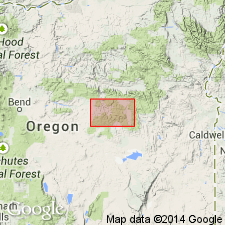
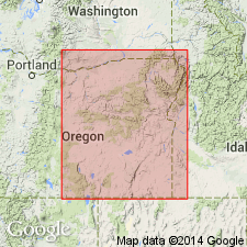
- Snake River basin
Summary:
Pg. 227 (table 1), 229, 247-255. Colpitts group. Name applied to sequence of limestone, sandstone, and shale which crops out only between Snow Mountain and Suplee in western end of pre-Tertiary area. Less than 500 feet thick in most places; may exceed 800 feet [near] Freeman Creek. Comprises two formations: Weberg below and Warm Springs above (both new). In type area, Colpitts lies across narrow southwestern part of eastward-trending Mowich anticline. Along western part of anticline, Colpitts lies upon Mowich group and below Hyde formation (new) without appreciable angular discordance. Where Mowich group is absent, as along Warm Springs Creek and in Camp Creek Valley, Colpitts lies upon Triassic and Paleozoic beds with high-angle discordance. Age is Middle Jurassic.
Type area: on east side of Warm Springs Creek Valley, in secs. 19, 20, 29, and 30, T. 18 S., R. 26 E., Crook Co., east-central OR. Named from Willard Colpitts Ranch on upper Warm Springs Creek.
Source: US geologic names lexicon (USGS Bull. 1200, p. 894).
- Usage in publication:
-
- Colpitts Group†
- Modifications:
-
- [Abandoned]
- AAPG geologic province:
-
- Snake River basin
Summary:
Pg. 13. [†Colpitts Group considered abandoned.] Lupher (1941) proposed Colpitts Group and divided it into Weberg Formation and Warm Springs Formation; strata exposed in Suplee area, central Oregon. Dickinson and Vigrass (1965) revised the Weberg and Warm Springs Formations to members of the Snowshoe Formation and discontinued use of Colpitts Group. (See also Weberg, Warm Springs, and Snowshoe).
See also Dickinson, W.R., and Vigrass, L.W., 1965, "Geology of the Suplee-Izee area, Cook, Grant, and Harney Counties, Oregon," Oregon Dept. Geol. and Min. Ind. Bull., no. 58, 109 p., geol. map (scale 1:42,000).
Source: Publication.
For more information, please contact Nancy Stamm, Geologic Names Committee Secretary.
Asterisk (*) indicates published by U.S. Geological Survey authors.
"No current usage" (†) implies that a name has been abandoned or has fallen into disuse. Former usage and, if known, replacement name given in parentheses ( ).
Slash (/) indicates name conflicts with nomenclatural guidelines (CSN, 1933; ACSN, 1961, 1970; NACSN, 1983, 2005, 2021). May be explained within brackets ([ ]).