- Usage in publication:
-
- Collins Ranch Member
- Modifications:
-
- Named
- Dominant lithology:
-
- Mudstone
- Sandstone
- Coal
- AAPG geologic province:
-
- Williston basin
Summary:
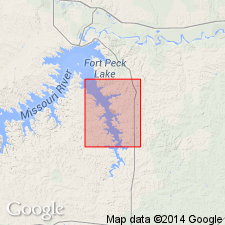
Named as the upper member of Tullock Formation for the Collins Ranch, Bug Creek quad, McCone Co, MT, Williston basin. Overlies the newly named Nelson Ranch Member of Tullock Formation; lower contact placed at top of W-coal zone. Underlies Lebo Formation; upper contact placed at base of U-coal zone. Type section measured in sec 12, T22N, R43E, and ends 600 m south and 60 m west of northeast corner. Its moderately resistant tan sandstones cap many of the mesas. Is 16.2 m thick at type where it consists of (in sequence): 1) gray to variegated mudstone interbedded with gray ledge-forming to platy sandstone; 2) coal and carbonaceous shale; 3) brown to gray sandstone with ironstone concretions; 4) coal and carbonaceous shale; 5) gray muddy sandstone. Measured sections. Geologic map. Columnar section. V-coal not present at type. Of early Paleocene age.
Source: GNU records (USGS DDS-6; Denver GNULEX).
For more information, please contact Nancy Stamm, Geologic Names Committee Secretary.
Asterisk (*) indicates published by U.S. Geological Survey authors.
"No current usage" (†) implies that a name has been abandoned or has fallen into disuse. Former usage and, if known, replacement name given in parentheses ( ).
Slash (/) indicates name conflicts with nomenclatural guidelines (CSN, 1933; ACSN, 1961, 1970; NACSN, 1983, 2005, 2021). May be explained within brackets ([ ]).

