The National Geologic Map Database is migrating to a new infrastructure. We apologize for any service disruptions during this process.
|
|---|


- Usage in publication:
-
- Collingsworth gypsum
- Modifications:
-
- Named
- Dominant lithology:
-
- Gypsum
- AAPG geologic province:
-
- Palo Duro basin
Summary:
Named as a unit (one of six named units) in Greer division for Collingsworth Co, TX just west of Greer Co, OK in the Palo Duro basin. No type locality designated. Is the uppermost gypsum ledge of the Greer. The gypsum is massive, white and cut by joints. Thickness varies from 18 to 20 ft. Top eroded at many localities. Overlies and underlies unnamed red clay shale of the Greer. Permian age.
Source: GNU records (USGS DDS-6; Denver GNULEX).
- Usage in publication:
-
- Collingsworth gypsum member†
- Modifications:
-
- Abandoned
Summary:
Collingsworth gypsum member of Greer formation presumably abandoned, because Greer formation is abandoned in this report. [Chaney, Kiser, Haystack, Cedartop, and Mangum, formerly members of the Greer, are also presumably abandoned.] For the so-called "eastern area" of the Greer, the name Cloud Chief formation is proposed. It is shown that the rocks in the "western area" of the Greer belong to Blaine, Dog Creek, Whitehorse, and Cloud Chief (new) formations. The report area, in southwestern Oklahoma, includes all or parts of 10 counties east, northeast, north, northwest and west of the Wichita Mountains, in the S. Oklahoma folded belt province and Anadarko basin. The new classification of the Permian of this area is as follows (ascending): Duncan sandstone (new), Chickasha formation (new), Blaine gypsum (revised), Dog Creek shale (rank raised), Whitehorse sandstone (rank raised), Day Creek dolomite (rank raised), Cloud Chief formation (new), and Quartermaster formation (revised). All of these units are stratigraphic equivalents of the Double Mountain, the uppermost Permian division of Texas. Age is Permian. Report includes geologic map.
[GNC states (see US geologic names lexicon, USGS Bull. 896, p. 490) that Gould (1924, p. 324-341) provisionally considered this unit to be same as Shimer gypsum member. On 1926 geologic map of Oklahoma, (by H.D. Miser), this gypsum was included in Blaine gypsum, and the equivalent Greer formation was abandoned.]
Source: Modified from GNU records (USGS DDS-6; Denver GNULEX).
- Usage in publication:
-
- Collingsworth Gypsum Bed
- Modifications:
-
- Revised
- AAPG geologic province:
-
- Palo Duro basin
- South Oklahoma folded belt
Summary:
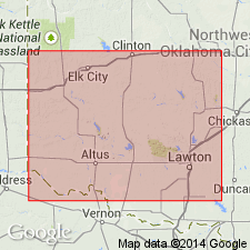
Reduced in stratigraphic rank from member of Blaine Formation. Reassigned as the uppermost named bed of Elm Fork Member (first used) of Blaine Formation of El Reno Group. Overlies Creta Dolomite Bed of Elm Fork. Underlies unnamed red-brown and green-gray shale at top of Elm Fork. Thickness ranges from 3-5 ft in east to 20-25 ft in northwest. Is 25-38 ft thick in Harmon Co. Present in Harmon and Jackson Cos in the Palo Duro basin and in Greer Co in the S. Oklahoma folded belt province. Consists of white fine- to coarse-crystalline dolomite. Measured sections. Cross sections. Permian age.
Source: GNU records (USGS DDS-6; Denver GNULEX).
For more information, please contact Nancy Stamm, Geologic Names Committee Secretary.
Asterisk (*) indicates published by U.S. Geological Survey authors.
"No current usage" (†) implies that a name has been abandoned or has fallen into disuse. Former usage and, if known, replacement name given in parentheses ( ).
Slash (/) indicates name conflicts with nomenclatural guidelines (CSN, 1933; ACSN, 1961, 1970; NACSN, 1983, 2005, 2021). May be explained within brackets ([ ]).