The National Geologic Map Database is migrating to a new infrastructure. We apologize for any service disruptions during this process.
|
|---|


- Usage in publication:
-
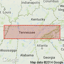
- College Hill limestone
- Modifications:
-
- Named
- Dominant lithology:
-
- Limestone
- AAPG geologic province:
-
- Cincinnati arch
Safford, J.M., 1869, Geology of Tennessee: Nashville, TN, 550 p.
Summary:
Named for College Hill, city of Nashville, Davidson Co., central TN. Is top division of Nashville formation. Consists of dark-blue, highly fossiliferous, coarsely crystalline and roughly stratified limestone with shaly layers. Generally weathers into rough, flaggy limestones and shaly matter interstratified, often liberating multitudes of fossils, especially small corals; some limestone layers are made up wholly of corals and shells. Lowest layers best exposed at top of bluff at Wire Bridge. Thickness is 120 ft. Overlies CYRTODONTA bed, a remarkable bed of coarsely crystalline, ashen-gray or light-yellowish-gray limestone, in great part made up of valves of many fossil species. [Age is Late Ordovician.]
Source: GNU records (USGS DDS-6; Reston GNULEX).
For more information, please contact Nancy Stamm, Geologic Names Committee Secretary.
Asterisk (*) indicates published by U.S. Geological Survey authors.
"No current usage" (†) implies that a name has been abandoned or has fallen into disuse. Former usage and, if known, replacement name given in parentheses ( ).
Slash (/) indicates name conflicts with nomenclatural guidelines (CSN, 1933; ACSN, 1961, 1970; NACSN, 1983, 2005, 2021). May be explained within brackets ([ ]).