The National Geologic Map Database is migrating to a new infrastructure. We apologize for any service disruptions during this process.
|
|---|


- Usage in publication:
-
- Cold Springs granite
- Modifications:
-
- First used
- Dominant lithology:
-
- Granite
- AAPG geologic province:
-
- South Oklahoma folded belt
Taylor, C.H., 1915, Granites of Oklahoma: Oklahoma Geological Survey Bulletin, no. 20, 108 p.
Summary:
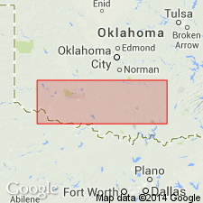
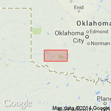
First used. Intent to name not stated; no type locality designated. Probably named for town of Cold Springs, Kiowa Co, OK in S. Oklahoma folded belt province, Wichita Mountains district. Cold Springs granite varies considerably in texture and mineral composition in different parts of the Cold Springs area, but is everywhere a fine-grained gray hornblende-biotite granite very similar to quartz monzonite in composition. Light-gray surface reveals specks of dark hornblende and biotite uniformly distributed through the fine-grained white and gray feldspar and quartz. The igneous geology of the Cold Springs area is the most complex in OK. Oldest and most abundant igneous rock is gabbro--in part olivine gabbro, in part augite gabbro, and in part anorthosite. During second period of igneous activity the gabbro was cut by dikes and irregular masses. Later the Cold Springs granite, which is near to a quartz monzonite, was intruded into the gabbro. Following this the region was fractured and all rocks were cut by more dikes and sills. Entire region is cut by strong joints, trending in various directions and spaced 2-20 ft apart. Cold Springs is of pre-Middle Cambrian age [based on the fact that all of the granites in the Wichita Mountains district are overlain unconformably by the Reagan sandstone which, according to Ulrich (1904), is Middle Cambrian]. Of Precambrian age. Geologic map.
Source: GNU records (USGS DDS-6; Denver GNULEX).
- Usage in publication:
-
- Cold Springs Breccia
- Modifications:
-
- Redescribed
- Dominant lithology:
-
- Breccia
- AAPG geologic province:
-
- South Oklahoma folded belt
Summary:
"Named" [actually a redescription of Taylor's (1915) Cold Springs granite] from defunct town of Cold Springs within type area of sec. 29, T. 4 N., R. 17 W., Kiowa County, Oklahoma, in the S. Oklahoma folded belt province. Shown on geologic map only in the environs of Cold Springs. Replaces use of name Cold Springs granite considered to be an "informal name" and as part of Wichita Granite Group by Ham and others (1964). The Cold Springs granite was a misnomer; the rock type varies from quartz monzonite to tonalite. The new Cold Springs, a unit of the western Glen Mountains, is an intrusion breccia composed of blocks of dark-gray microdiorite (from the Otter Creek Microdiorite) in a matrix of light-pink leucogranite or aplite. With the breccia are some medium-gray, variably heterogeneous intermediate rocks derived from the interaction of the aplite and the microdiorite. Intrudes the /Raggedy Mountain Gabbro Group, and the Otter Creek Microdiorite. Relation to Wichita Granite Group uncertain. Assigned to the Cambrian. Report includes stratigraphic chart.
Source: GNU records (USGS DDS-6; Denver GNULEX).
For more information, please contact Nancy Stamm, Geologic Names Committee Secretary.
Asterisk (*) indicates published by U.S. Geological Survey authors.
"No current usage" (†) implies that a name has been abandoned or has fallen into disuse. Former usage and, if known, replacement name given in parentheses ( ).
Slash (/) indicates name conflicts with nomenclatural guidelines (CSN, 1933; ACSN, 1961, 1970; NACSN, 1983, 2005, 2021). May be explained within brackets ([ ]).