- Usage in publication:
-
- Colchester (No. 2) coal member
- Modifications:
-
- Principal reference
- Dominant lithology:
-
- Coal
- AAPG geologic province:
-
- Illinois basin
Summary:
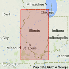
Pg. 34, 35, 36, 46 (table 1), 62, 67, pl. 1. Colchester (No. 2) coal member of Carbondale formation of Kewanee group (new). Basal member of Carbondale formation. Occurs below Shawneetown coal member (new) or below Francis Creek shale member. In western and northern area, replaces LaSalle (No. 2) coal so that name LaSalle can be retained for LaSalle limestone. Thickness about 2 feet. Age is Pennsylvanian. Report presents new rock-stratigraphic classification of Pennsylvanian strata in Illinois. Cyclical classification retained but is entirely independent of rock-stratigraphic classification.
Type locality: in secs. 12 and 13, T. 5 N., R. 4 W., Colchester quadrangle, McDonough Co., western IL. Coal named by Worthen (1868, IN Geology and Paleontology, v. 3, Illinois Geol. Survey). [Worthen reports available online from the Univ. Chicago Library: http://worthen.lib.uchicago.edu/ (accessed July 1, 2010).]
Source: US geologic names lexicon (USGS Bull. 1200, p. 877-878).

- Usage in publication:
-
- Colchester (No. 2) Coal Member
- Modifications:
-
- Overview
- AAPG geologic province:
-
- Illinois basin
Summary:
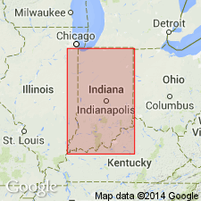
Pg. 38-39 (article by A.M. Burger and C.E. Wier), table 3. Colchester (No. 2) Coal Member of Linton Formation adopted in Indiana terminology (Wier and Gray, 1961) because of the continuity of this coal with the Illinois type. A relatively thin (0.1 to 3 feet) bright-banded coal commonly displaying a thin medial shale parting. Overlies a persistent underclay, 1 to 4 feet thick, which is mined and used for ceramics. Lies from a few inches to 40 feet above the Seelyville Coal Member of Staunton Formation. Underlies Mecca Quarry Shale Member (of Zangerl and Richardson, 1963), a black fissile shale, 1 to 7 feet thick, containing abundant vertebrate and invertebrate fossils and iron-rich concretions. Lies 5 to 50 feet below Survant Coal Member of Linton Formation. Probably equivalent to Schultztown Coal of western Kentucky. Previously designated Coal IIIa by Ashley (1909, p. 55-57). In Pike and Warrick Counties this unit was previously known as the Velpen Coal (Fuller and Ashley, 1902, p. 2), but the name Velpen is now used for the overlying limestone. Age is Pennsylvanian.
Traceable on outcrop from Spencer County on the Ohio River to the Vermillion River in northern Vermillion County.
See also:
Ashley, 1909, Indiana Dept. Geol. Nat. Res. Ann. Rpt., no. 33.
Fuller and Ashley, 1902, USGS Geol. Atlas of the US, Patoka folio, no. 105.
Wier and Gray, 1961, Indiana Geol. Survey Regional Geol. Map, Indianapolis sheet.
Zangerl and Richardson, 1963, Fieldiana Geol. Mem., v. 4.
Source: Publication.

- Usage in publication:
-
- Colchester (No. 2) Coal Member
- Modifications:
-
- Overview
- AAPG geologic province:
-
- Illinois basin
Summary:
Pg. 187. Colchester (No. 2) Coal Member of Carbondale Formation of Kewanee Group. The Colchester (No. 2) Coal, the lowest member of Carbondale, was designated No. 2 by Worthen (1866, p. 59) for the coal in a mine shaft at Highland, Madison County. Worthen also used the name Colchester for the same coal at Colchester, McDonough County (1868, p. 11), and also (1870, p. 96-97) for an exposure 1.5 miles west of Vermont, Fulton County. Wanless (1956, p. 10) designated exposures near Colchester as the type section (secs. 12, 13, T. 5 N., R. 4 W.). The coal has also been called the La Salle (No. 2) Coal or the "Third Vein" coal in northern Illinois. The Colchester Coal is a normal, bright-banded coal (fig. P-3C). It is very extensive in Illinois and is thought to be one of the most widespread coals in the United States. It is generally thin, varying from a fraction of an inch to 18 inches in southern, central, and eastern Illinois, and is rather uniformly 2 to 3.5 feet thick throughout much of northern and western Illinois, where it has been extensively mined. It is overlain directly by either the black Mecca Quarry Shale Member, or, in parts of western and most of northern Illinois, by the gray Francis Creek Shale Member. It is underlain by a well developed underclay. It is correlated with the Croweburg coal of Missouri and Kansas, the Schultztown of western Kentucky, the Broken Arrow or Croweburg of Oklahoma, the Whitebreast of Iowa, the Colchester Coal Member (IIIa) of Indiana, and tentatively with the Lower Kittanning Coal of the Appalachian field (Wanless, 1957). Age is Middle Pennsylvanian (Desmoinesian).
Source: Publication.

- Usage in publication:
-
- Colchester Coal Member
- Modifications:
-
- Reference
- AAPG geologic province:
-
- Illinois basin
Summary:
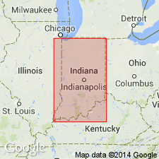
Indiana Geological Survey drillhole SDH 306 is herein designated the reference core for the Houchin Creek Coal Member of the Petersburg Formation; the Survant Coal, Velpen Limestone, Mecca Quarry Shale, and Colchester Coal Members of the Linton Formation; the Seelyville Coal Member of the Staunton Formation; and the boundary between the Petersburg and Linton Formations. SDH 306 is located near the type section of the Survant Coal Member, in SW1/4 NE1/4 sec. 2, T2S, R7W, Pike Co., southern IN. Unit has been traced from Spencer Co. on the Ohio River to the Vermillion River in northern Vermillion Co. Easily recognized by its close association with the overlying Mecca Quarry Shale and Velpen Limestone Members. Described in the reference core as (descending) 0.8 ft of bright-banded vitrain, calcite on cleats, trace of fusain; 0.1 ft of coal shale; and 0.1 ft of bright-banded vitrain calcite on cleats.
Source: GNU records (USGS DDS-6; Reston GNULEX).

- Usage in publication:
-
- Colchester Coal Member
- Modifications:
-
- Revised
- AAPG geologic province:
-
- Illinois basin
Summary:
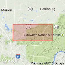
The Spoon-Carbondale boundary of Kosanke et al (1960) is revised. Base of the Carbondale is moved downward 70 or 80 ft, from the base of the Colchester Coal Member to the base of the Davis Coal Member.
Source: GNU records (USGS DDS-6; Reston GNULEX).
For more information, please contact Nancy Stamm, Geologic Names Committee Secretary.
Asterisk (*) indicates published by U.S. Geological Survey authors.
"No current usage" (†) implies that a name has been abandoned or has fallen into disuse. Former usage and, if known, replacement name given in parentheses ( ).
Slash (/) indicates name conflicts with nomenclatural guidelines (CSN, 1933; ACSN, 1961, 1970; NACSN, 1983, 2005, 2021). May be explained within brackets ([ ]).

