The National Geologic Map Database is migrating to a new infrastructure. We apologize for any service disruptions during this process.
|
|---|


- Usage in publication:
-
- Cokeville Formation*
- Modifications:
-
- Named
- Dominant lithology:
-
- Sandstone
- Siltstone
- Claystone
- Mudstone
- AAPG geologic province:
-
- Green River basin
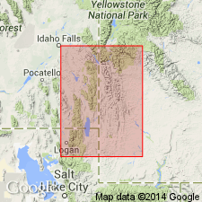
Summary:
Named for town of Cokeville, Lincoln Co, WY. Type section designated 2 mi northeast of town along north side of Smiths Fork, SW1/4 sec 36, T25N, R119W, in the Greater Green River basin. Consists of light-gray to tan-weathering medium-gray fossiliferous sandstone and sandy siltstone, light- to dark-gray claystone and mudstone that have calcareous concretions, abundantly fossiliferous tan limestone, and some beds of light-gray, tan, and pink porcelanite and bentonite. A few coal beds present in upper part. Is 1,609 ft thick at the type section; is 1,900-2,500 ft thick in Sage quad. Upper and lower contacts are arbitrary; intertongues with underlying Thomas Fork Formation and with overlying Quealy Formation, both named in this report. Fossils found in Cokeville are similar to Bear River Formation to the east. Is of Early Cretaceous age.
Source: GNU records (USGS DDS-6; Denver GNULEX).
- Usage in publication:
-
- Cokeville Formation*
- Modifications:
-
- Areal extent
- Biostratigraphic dating
- Mapped 1:100k
- Dominant lithology:
-
- Mudstone
- Siltstone
- Sandstone
- Limestone
- AAPG geologic province:
-
- Uinta uplift
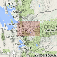
Summary:
Is Lower Cretaceous formation mapped in northeastern part of map area in Summit Co, UT (Uinta uplift). Overlies Thomas Fork Formation (Lower Cretaceous). Is overlain by Sage Junction Formation (Lower Cretaceous). Map unit described as interbedded dark-gray, carbonaceous, shaly mudstone and siltstone, yellowish-gray-weathering sandstone, and very fossiliferous gray to tan limestone and coquina. Occurs only in upper Chalk Creek area. About 500 m thick. Unit is geographically extended into the Uinta uplift, UT. Palynomorphs recovered from four samples. Samples are assigned to the CHICHAOUADIUM ("SPINIDINIUM") VESTITUM palynostratigraphic zone (upper Albian).
Source: GNU records (USGS DDS-6; Denver GNULEX).
For more information, please contact Nancy Stamm, Geologic Names Committee Secretary.
Asterisk (*) indicates published by U.S. Geological Survey authors.
"No current usage" (†) implies that a name has been abandoned or has fallen into disuse. Former usage and, if known, replacement name given in parentheses ( ).
Slash (/) indicates name conflicts with nomenclatural guidelines (CSN, 1933; ACSN, 1961, 1970; NACSN, 1983, 2005, 2021). May be explained within brackets ([ ]).