- Usage in publication:
-
- Cohn coal member
- Modifications:
-
- Principal reference
- Dominant lithology:
-
- Coal
- AAPG geologic province:
-
- Illinois basin
Summary:
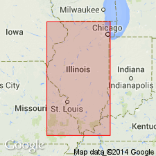
Pg. 41, 51 (table 1), 83, pl. 1. Cohn coal member of Mattoon formation (new) of McLeansboro group. Name applied to coal member in lower part of formation. Stratigraphically below Merom sandstone member. Thickness 2 inches. Recognized in eastern Illinois. Age is Pennsylvanian. Report presents new rock-stratigraphic classification of Pennsylvanian strata in Illinois. Cyclical classification retained but is entirely independent of rock-stratigraphic classification.
Type locality: in NE/4 sec. 1, T. 11 N., R. 12 W., Marshall 15-min quadrangle, Clark Co., eastern IL. Exposure is 2 mi northwest of Cohn, now called Livingston. Coal named by Newton and Weller (1937, Illinois Geol. Survey Rpt. Inv., no. 45, p. 18).
[Misprint (US geologic names lexicon, USGS Bull. 1200, p. 875): type locality is 2 mi northwest of Livingston (Cohn), not southeast.]
Source: Publication; US geologic names lexicon (USGS Bull. 1200, p. 875).

- Usage in publication:
-
- Cohn Coal Member
- Modifications:
-
- Overview
- AAPG geologic province:
-
- Illinois basin
Summary:
Pg. 199. Cohn Coal Member of Mattoon Formation of McLeansboro Group. The Cohn Coal Member of the Mattoon Formation (Newton and Weller, 1937, p. 18) is named for Cohn (now called Livingston), Clark County. The type section consists of an exposure on the south side of Big Creek, about 2.5 miles from Livingston (in NE/4 sec. 1, T. 11 N., R. 12 W.). The Cohn Coal occurs in eastern Illinois, where it is generally less than 10 inches thick. At its type locality it is only 2 inches thick, and it lies 22 feet above the Livingston Limestone and 12 feet below the base of the Merom Sandstone. A 16-inch thick nodular limestone containing numerous SPIRORBIS occurs 2 feet above the coal. To the south in Crawford County, the Cohn Coal is correlated with a thin coal that has been mined in the vicinity of Flat Rock. In that area the Cohn Coal lies at or very near the base of the Merom Sandstone, which may have eroded the coal in some areas. Age is Late Pennsylvanian (Missourian).
Source: Publication.
For more information, please contact Nancy Stamm, Geologic Names Committee Secretary.
Asterisk (*) indicates published by U.S. Geological Survey authors.
"No current usage" (†) implies that a name has been abandoned or has fallen into disuse. Former usage and, if known, replacement name given in parentheses ( ).
Slash (/) indicates name conflicts with nomenclatural guidelines (CSN, 1933; ACSN, 1961, 1970; NACSN, 1983, 2005, 2021). May be explained within brackets ([ ]).

