

- Usage in publication:
-
- Coharie formation*
- Modifications:
-
- Original reference
- Dominant lithology:
-
- Clay
- Sand
- Gravel
- AAPG geologic province:
-
- Atlantic Coast basin
Summary:
Pg. 273-277. Coharie formation of Columbia group. Sandy clays, sands, more or less argillaceous or arkosic, and gravels. Almost everywhere gravels or coarse sands constitute basal beds; these are irregularly bedded, and in many places exhibit cross bedding. In almost all sections the coarser materials at base grade up into unstratified argillaceous sands or sandy clays; and these in turn into a soil of gray sand or sandy or clayey loam. Over large areas the immediate surface materials, from a few inches to 2 or 3 feet thick, consist of loose gray sands. Thickness of deposits 25 to 50 feet. Upper surface of Coharie deposits forms a terrace plain, more or less dissected, which slopes up from elevations of about 100 to 170 feet along its southeastern edge to about 230 or 235 feet along foot of escarpment which separates it from the Lafayette belt. Oldest formation of Columbia group in North Carolina. [Age is Pleistocene.]
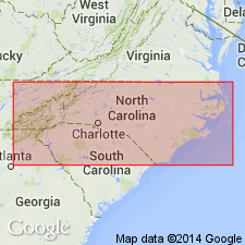
Named from Great Coharie Creek, a tributary of Black River in NC. The terrace plain formed by surface of the formation has a widespread development on either side of the narrow valley of this creek in northern half of Sampson Co.
Source: US geologic names lexicon (USGS Bull. 896, p. 483-484).
- Usage in publication:
-
- Coharie formation
- Modifications:
-
- Revised
- AAPG geologic province:
-
- Atlantic Coast basin
Summary:
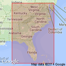
Pg. 503-518. Coharie formation of Columbia group. Proposed to restrict Coharie formation to the 215-foot level. The terrace formations of Columbia group (including the Coharie) now recognized by Cooke from Delaware to southern Georgia and probably into Florida, are enumerated herein under Columbia group. [Age is Pleistocene.]
Source: US geologic names lexicon (USGS Bull. 896, p. 483-484).
- Usage in publication:
-
- Coharie Formation
- Modifications:
-
- Not used
- AAPG geologic province:
-
- Atlantic Coast basin
- South Georgia sedimentary province
Summary:
The concepts of Silver Bluff, Princess Anne, Pamlico, Talbot, Wicomico, Sunderland, Coharie, and Brandywine Formations are invalid, and these names should be abandoned in lithostratigraphic sense. Most names may be retained for marine terraces. [Author does not mention treatment of the unit outside of GA.]
Source: GNU records (USGS DDS-6; Reston GNULEX).
For more information, please contact Nancy Stamm, Geologic Names Committee Secretary.
Asterisk (*) indicates published by U.S. Geological Survey authors.
"No current usage" (†) implies that a name has been abandoned or has fallen into disuse. Former usage and, if known, replacement name given in parentheses ( ).
Slash (/) indicates name conflicts with nomenclatural guidelines (CSN, 1933; ACSN, 1961, 1970; NACSN, 1983, 2005, 2021). May be explained within brackets ([ ]).