The National Geologic Map Database is migrating to a new infrastructure. We apologize for any service disruptions during this process.
|
|---|


- Usage in publication:
-
- Coffeyville formation*
- Modifications:
-
- Original reference
- Dominant lithology:
-
- Limestone
- Shale
- AAPG geologic province:
-
- Cherokee basin
Summary:
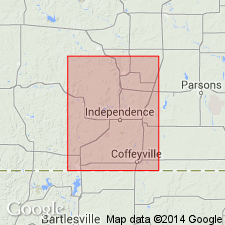
Pg. 448. Coffeyville formation. Series of limestones and shales, 250 feet thick, underlying Drum formation and overlying Parsons formation. Includes Cherryvale shale, Dennis [Winterset] limestone, Galesburg shale, Mound Valley [Bethany Falls] limestone, and Ladore-Dudley shale. Age is Pennsylvanian.
Named from exposures at Coffeyville, Montgomery Co., southeastern KS.
[GNC remark (ca. 1938, US geologic names lexicon, USGS Bull. 896, p. 482): In northeastern Oklahoma overlies Lenapah limestone and underlies Hogshooter limestone.]
Source: US geologic names lexicon (USGS Bull. 896, p. 482).

- Usage in publication:
-
- Coffeyville formation*
- Modifications:
-
- Overview
- AAPG geologic province:
-
- Cherokee basin
Summary:
Pg. 67. Coffeyville formation of Schrader and Haworth includes beds between top of Lenapah limestone and base of true Drum limestone.
Source: US geologic names lexicon (USGS Bull. 896, p. 482).
- Usage in publication:
-
- Coffeyville formation
- Modifications:
-
- Revised
- AAPG geologic province:
-
- Cherokee basin
Summary:
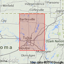
Pg. 39, 40. Coffeyville formation of Skiatook group. Name Coffeyville restricted to strata between top of Checkerboard limestone below and base of (Hogshooter) Dennis formation above. Age is Late Pennsylvanian (Missourian).
Source: US geologic names lexicon (USGS Bull. 1200, p. 873-874).
- Usage in publication:
-
- Coffeyville formation
- Modifications:
-
- Areal extent
- AAPG geologic province:
-
- Cherokee basin
Summary:
Pg. 33-39. Coffeyville formation. Consists of seven zones, four of shale and three of sandstone. Thickness 175 to 235 feet. In all but a few localities, the Winterset (upper) member of Hogshooter is the capping bed, but locally the Coffeyville is succeeded by the Canville, Stark, or Lost City members. Age is Late Pennsylvanian (Missourian).
Source: US geologic names lexicon (USGS Bull. 1200, p. 873-874).
- Usage in publication:
-
- Coffeyville formation
- Modifications:
-
- Areal extent
- AAPG geologic province:
-
- Cherokee basin
Summary:
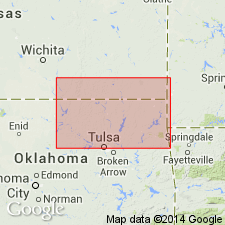
Pg. 57-60. In Tulsa County [Oklahoma], consists of five zones, two of sandstone, and three of shale. Thickness as much as 440 feet. Age is Late Pennsylvanian (Missourian).
Source: US geologic names lexicon (USGS Bull. 1200, p. 873-874).
- Usage in publication:
-
- Coffeyville formation
- Modifications:
-
- Revised
- AAPG geologic province:
-
- Cherokee basin
Summary:
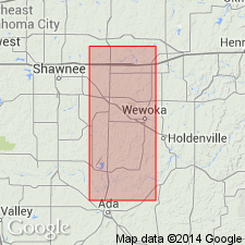
Pg. 63-70. Coffeyville [formation], in Seminole County [Oklahoma], is made up of six lithologic units. De Nay limestone member, a shale, a middle (No. 1) sandstone, a shale, and upper (No. 2) sandstone, and a shale. Maximum thickness 260 feet. Overlies Seminole formation; underlies Nellie Bly formation. Interval designated by Morgan (1924, Oklahoma Bur. Geol. Bull., no. 2) as Francis formation is herein described under headings of Coffeyville and Nellie Bly. Age is Late Pennsylvanian (Missourian).
Source: US geologic names lexicon (USGS Bull. 1200, p. 873-874).
- Usage in publication:
-
- Coffeyville formation
- Modifications:
-
- Areal extent
- AAPG geologic province:
-
- Cherokee basin
Summary:
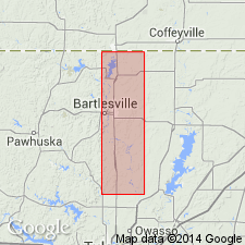
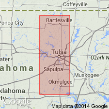
Pg. 14, 17-20, pls. 1, 2. Coffeyville formation of Shiatook group. Described in Creek County [Oklahoma], where it conformably overlies Checkerboard limestone and conformably underlies Hogshooter formation. Shiatook group. Thickness 375 to 500 feet. Name Coffeyville not in current use in Kansas.
Source: US geologic names lexicon (USGS Bull. 1200, p. 873-874).
For more information, please contact Nancy Stamm, Geologic Names Committee Secretary.
Asterisk (*) indicates published by U.S. Geological Survey authors.
"No current usage" (†) implies that a name has been abandoned or has fallen into disuse. Former usage and, if known, replacement name given in parentheses ( ).
Slash (/) indicates name conflicts with nomenclatural guidelines (CSN, 1933; ACSN, 1961, 1970; NACSN, 1983, 2005, 2021). May be explained within brackets ([ ]).